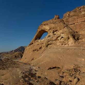
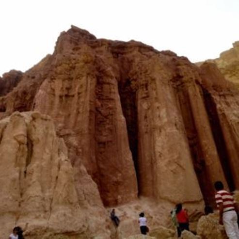
The Great Arch and the Ancient Copper Mines at Timna Park
Families, hikers
Trail Color Markers: red and blue at the end
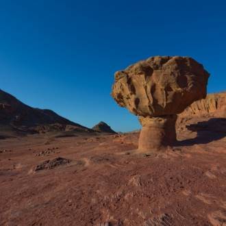
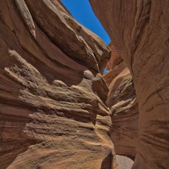
From the parking lot, you will follow the red trail marker up the stairs, and you will see the rock cliff facing the great stone arch. You will cross the bedrock surface, and you will notice the mining shafts from the Egyptian period of activity in Timna (about 3,300 years ago).
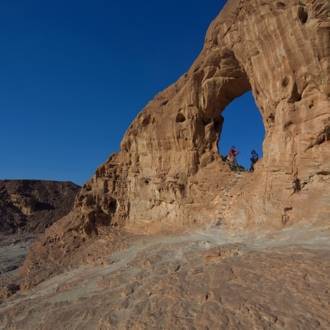
On the wall of the shafts, diagonal marks indicate the use of chisels for quarrying. The niches were hewn to help climb and move inside the shaft. You will continue following the red marker and climb to the arch using the hand and foot holds set in the rock. From the arch, there is an observation point to the east and north of Timna Valley and Mt. Timna. On the other side of the arch, you will descend the ladder to a narrow sandy crevice, along with the red trail marker next to the slope of the rock. You will meet the clear marker (two white stripes with no color between them) which will after a few meters leads you to a narrow curve in the sandstone cliff. You will return to the red marker and continue with it until the Egyptian miner's cave.
Inside the cave was a mining shaft from the Egyptian period of Timna, or a little after the reign of Solomon. You have two options: to continue with the red marker westward and parallel to the stream channel or to turn with the black marker that will later connect to the red trail marker.
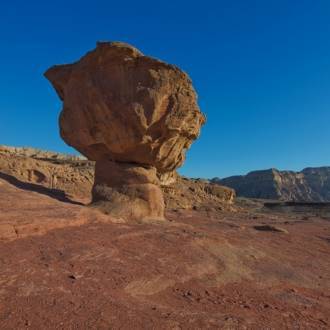
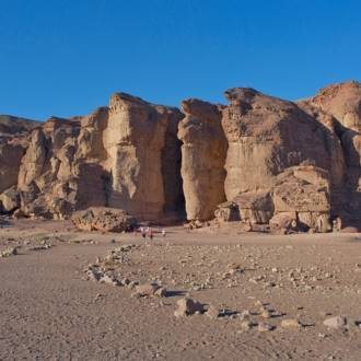
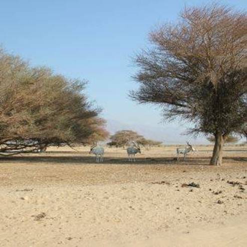
The black trail marker begins with climbing through the cave on its right side to the observation point above it. You will climb over the observation point on a diagonal ladder to another higher observation point at the top of the sandstone cliff. In this section of the trail, you can see a comprehensive view of the Timna Valley: the Timna cliffs surround the valley from the north, west, and south, and together with Timna Mountain in the center of the eastern part of the valley, a horseshoe structure opens eastward towards the Arava. Below you and southward of the foot of the cliff, you can see the surfaces of the 'plates.' Above you, the antennas at the top of Mt. Berekh are visible to the west. You will continue along the path through a natural rock gate and begin to descend in a small channel until again meeting with the red trail marker.
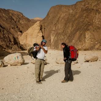
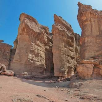
You will continue with the red marker and go down the channel on the rock steps and reach a wider section where ancient mining tunnels reside.
On the mining shafts, there are two types of marks that indicate the use of different quarrying tools in different periods. The darker more blunt marks, a mosaic of dots, are the result of working with stone tools and are from an earlier period. Probably during the Chalcolithic period more than 5,000 years ago. The sharper diagonal marks indicate the use of metal/bronze tools during the Late Bronze Age about 3,300 years ago. Immediately after the opening of the mines, you will meet the blue trail marker and a sign directing you to the parking lot. You will ascend the channel and notice the openings of mines from the Chalcolithic period on the ground surrounded by a fence.
According to what we know today, these copper mines are among the oldest in the world. An opening in the fence allows us to climb down and crawl through one until you exit through another opening. You will follow the blue trail marker which will take you back to the parking lot.
Written by: Assaf Holzer
Photo: Dafna Tal for the Israeli Ministry of Tourism
- Tipo
- Excursionismo
- Región
- Eilat
- Longitud
- 2.5 km
- Duración
- hours 1-2
- Nivel de dificultad
- Medio
- Punto de partida
- Timna Park (mapa)
- Punto final
- The Great Arch, Timna Park (mapa)
- Mapa
- Map no. 20
- Estacionamiento
- Estacionamiento
- Admission
- Cargo de admisión
- Agua potable
- Agua potable
- Apto para niños
- Apto para niños
- Picnic adecuado
- Picnic adecuado
- Teléfono
- +972-8-6616976
- tayaroot@gmail.com
Senderos similares
Ancient volcanic activity, sandstone palaces and rock paintings at Timna Park
Atracciones cercanas

Restaurantes cercanos