Through the canyons and copper mines at Timna Park
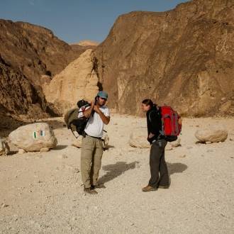
Families, hikers
"Trail Color Marker: black and blue
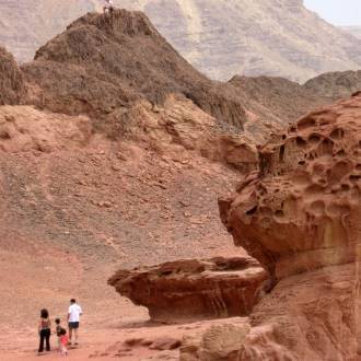
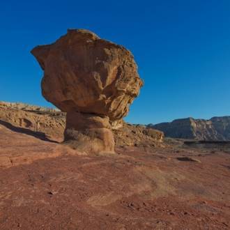
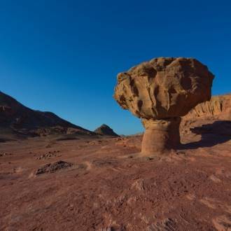
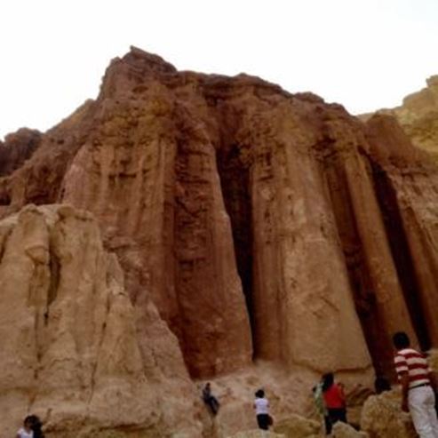
From the road, we turned westward up a ravine. After about two kilometers you will reach multiple trails: the black marking turns left, southwest and leaves the valley to the top of the cliffs surrounding it. You will follow the blue marker to the right, heading north-west. You will continue up the sandstone channels, which have red, pink and purple tones, and you will emerge up to a bright dune. You will continue up another dune along the waterway of the valley. Behind you, to the south, are the channels that drain into Nahal Nechushtan and the southern outlet of the valley to the Arava. Northward, the beginning of the channels draining into Nahal Timna, which leads to the Arava north of Mt.Timna. In front of you are ""plates"" - ancient mining shafts that have been covered.
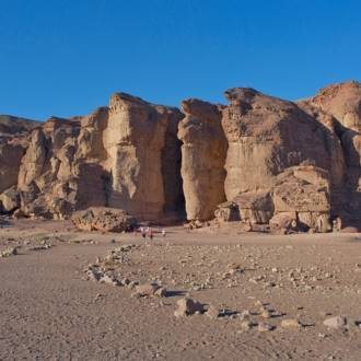
You will follow the trail marker through the field of plates and descend to the channel. The route continues down the channel to a short section of white sandstone - the White Canyon. There is a vertical shaft carved parallel to the canyon wall, visible on the wadi wall. The channel expands, and you will reach the green trail marker that crosses the trail. You will continue following the blue marker through another short canyon section. As you walk through the wadi channel, you will observe horizontal mines that open to the channel. Your route continues to the Pink Canyon - a narrow gorge with pink sandstone.
About 100m from the canyon, to the right, is the Roman Cave. This is how the rock shelter at the southern side of the gorge was named. Inside the space, on the right are the remains of an ancient structure, and on the left are inscriptions on the wall, mistakenly giving the name the ""Roman Cave."" In fact, this is a Nabatean burial text written in Greek. You will continue down the wadi following the blue marker until you meet another channel on the left and the black trail marker. You will continue with the blue marker up the channel until you meet the red trail marker and a sign pointing right to the parking lot. You will turn right with the signs, climb from the ravine and pass by the openings of mines surrounded by a fence. These are the earliest known copper mines in the world. From there with the blue marker, you will reach the end of the trail in the parking lot of the Arches site.
Written by: Assaf Holzer
Photo: Hagit Gal
- Rodzaj
- Wędrówki
- Region
- Ejlat
- Długość
- 5 km
- Trwanie
- hours 4
- Pole namiotowe
- Średni
- Punkt początkowy
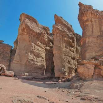
- Shlomo columns, Timna Park (mapa)
- Punkt końcowy
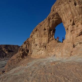
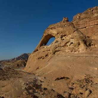
- The Great Arch, Timna Park (mapa)
- Mapa
- Map no. 20
- Parking
- Parking
- Admission
- Opłata za wstęp
- Woda pitna
- Woda pitna
- Odpowiedni dla dzieci
- Odpowiedni dla dzieci
- Odpowiednie na piknik
- Odpowiednie na piknik
- Telefon
- +972-8-6616976
- tayaroot@gmail.com
Podobne szlaki
Ancient volcanic activity, sandstone palaces and rock paintings at Timna Park
Atrakcje w pobliżu

Najbliższe restauracje