Nahal Seifim (Seifim Stream)
A short walk in a channel with boulders
Mesiv Eilat Nature Reserve
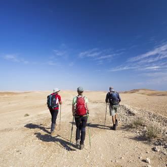
The NPA recently marked out a trail in Nahal Seifim, thus giving the public the experience of a desert hike through the Eilat Mountains, jumping over big rocks and an opportunity to become more familiar with the desert flora growing in the Eilat Mountains. The trail connects Seifim Plain to the trail of northern Wadi Shani (Shani Stream).
Main Points of Interest
A fun walk between rocks
Desert flora
Observation Points
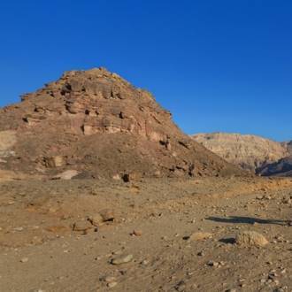
There is an observation point off the dirt road that has black trail marks, about 750 meters from the road, which overlooks the Seifim Plain and the acacia tree that marks the start of the trail.
NPA Activities to Improve Services to Visitors and to Conserve the Site
The NPA has prepared a parking area, marked the trail and is working to save the jujubes in Wadi Shani.
How to Get There
Take Highway 12 from Eilat. About 3 km after the entrance to the Red Canyon (between km 22 and 23), turn right (east) along the dirt road marked in black.
Background
The name Nahal Seifim does not appear on maps, and to this day, it is far from the hearts and minds of hikers. The new trail makes the Wadi Shani area more accessible and is one of the most beautiful trails on the Eilat Mountains.
A dirt road marked in black turns east off the road to an old patrol road (marked in red), where the IDF patrolled until the Six Day War. The spot where the road begins to wind downward to the Seifim Valley is a good place to stop and take a look. In the eastern side of the valley, you can clearly see a big twisted acacia. That’s the spot marking the beginning of the trail.
Trail
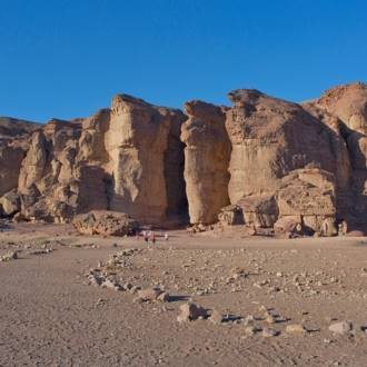
Observation Point Overlooking Seifim Plain
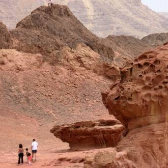
Seifim Plain is a valley of about 2 km long. The valley was formed by the erosion of six sections of channels that descend into it. The branches between the channels look like fingers, hence the name “the Valley of Fingers” given to it by fighters during the War of Independence. The valley was an outpost of the reconnaissance company that went down there during Operation Uvda. The company’s commander was Avraham "Bren" Adan. On March 10, 1949, Nahum Sarig arrived in the valley. He gave Adan the famous Ink Flag and ordered him to walk quickly to Umm Rashrash and to take control of the place after the legionnaires abandoned it. Sarig looked for a way for his two jeeps (one could only dream then of Highway 12), and the only solution he found was to go through Moon Valley, in Egyptian territory. Sarig picked up Adan and two of his soldiers along the way. The small force arrived in Umm Rashrash in the afternoon, and Adan was given the honor of hanging the Ink Flag at the top of the mast of Umm Rashrash – the city we know as Eilat.
Acacia and Perhaps Egyptian Meadow-Saffron
Go down the patrol road (with red trail marks). Visitors in January should look for the Egyptian meadow saffron. These flowers were first found blooming slightly north of here on the sides of roads in the 1990s. Egyptian meadow saffron usually grows in the Negev, in sandy soil, in loess soil between Beersheba and Yeruham, and the Seifim Plain is the southernmost place in Israel it can be found.
Park by the acacia, a prominent landmark in the landscape. The Seifim Plain is 750 meters above sea level, and of all the acacias in Israel, only Acacia pachyceras is able to cope with the prevailing cold here in winter. The tree grows in the riverbed that drains the entire valley, and the amount of water that flows here ensures its survival.
From here, we continue by foot, following the green trail marks.
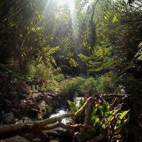
Nahal Seifim
Nahal Seifim receives relatively large quantities of water and as such, it is rich in vegetation. On the way, we see our usual representatives in the desert – white broom, desert baby's breath, fragrant oxeye, and jointed anabis. About half a kilometer further, we reach beautiful rock surfaces, and immediately after them, a step waterfall. At the bottom, two acacias grow, further evidence of the water that flows here after it rains.
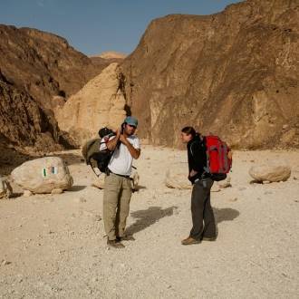
the riverbed awaits hikers now for a walk of 1.5 km between rocks and large boulders that have tumbled in. Walk slowly and jump carefully. After the rain, the small cisterns fill with water. Slide down the 3-meter slanted waterfall and continue until the meeting point between the bigger channel of Nahal Shani (black trail marks). Here we turn right and arrive immediately at the old patrol road, marked with red trail marks.
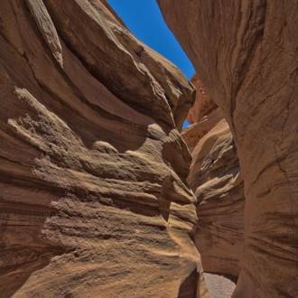
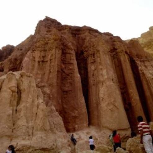
Meeting Point with Nahal Shani
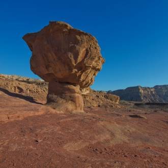
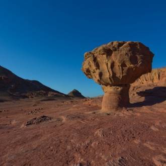
The meeting point with Nahal Shani (upper Shani track) is quite remarkable. Here we leave the limestone rock world and enter the colorful world of sandstone. A few impressive acacias grow in the riverbed but pay attention to the small jujubes upstream. These are Ziziphus nummularia (hairy jujube), and this is the only place in Israel where you’ll find them. Young branches are covered with a dense plume of hair, which fall off over time, and this is how the tree got its name. The hairy jujube’s fruit is small and round, about 8 mm in diameter, and the animals that live here feed on them greedily.
The End of the Trail
This is where the trail ends for those who organized a vehicle to pick them up. If you didn’t do so, return to the beginning via the old patrol road (turn right), an easy hike of about 2 km. You can continue down the black path. It passes by the upper Nahal Shani, and leads to the Red Canyon.
- Type
- Hiking
- Region
- Eilat
- Length
- 2.2 km circular route: about 4.2 km (back on a convenient dirt road)
- Duration
- About 2 hours
- Recommended season
- Spring, Autumn, Winter
- Starting point
- Nahal Seifim (map)
- Ending point
- Nahal Seifim (map)
- Special equipment
- Shoes, hat, water
- Precautions
- The turn from road 12 to the dirt road is permitted only from the direction of Eilat. Do not cross a white dividing line. Be careful walking on the rocks and between them
- Parking
- Parking
- Circular
- Circular
- Suitable for children
- Suitable for children
- Phone
- +972-8-6326422
- Fax
- +972-8-6375776
- st.almogim@npa.org.il
Similar trails
Ancient volcanic activity, sandstone palaces and rock paintings at Timna Park
Nearby attractions

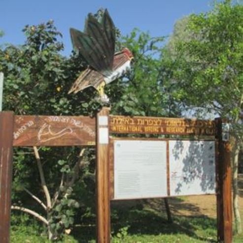
Eilat Bird Watching Center
Nearby restaurants