Ancient volcanic activity, sandstone palaces and rock paintings at Timna Park
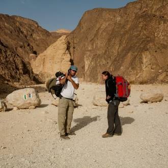
Families, hikers
Black and red trail color markers
The trail begins next to the Acacia tree that grows adjacent to the road to the north. Among the branches of the tree, you will notice another plant with dark green fleshy leaves. It is a semi-parasitic plant called Loranthus. It utilizes the root system and trunk of the Acacia tree through which it sucks the water and minerals from the soil. You will cross the trail at the Nahal Timna wadi and notice a device designed to measure the amount of water flowing during floods. The continuation of the trail is on one of the many dirt roads that were breached by the Timna mining plants for drill testing and surveys to locate copper deposits. Your path continues through the riverbed between a few Acacia trees and some bushes.
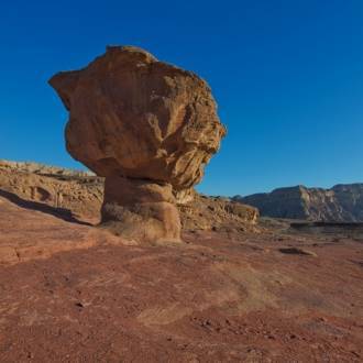
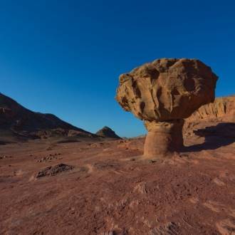
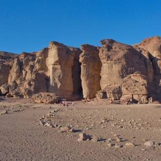
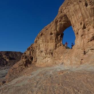
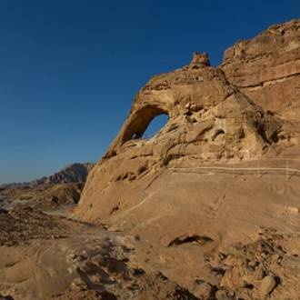
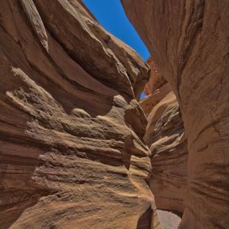
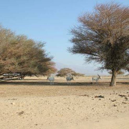
On the ground, you may see deer tracks, and sometimes there are deer droppings, which are called 'sniffing stations.' This is the male deer's way of marking his territory. As you continue through the wadi, you'll see two barrels, and you will reach an area where you can see evidence of volcanic activity that occurred in the area more than 100 million years ago. On the right and left, on the side of the wadi, you will notice the exposed reddish clay in which we discern the outer rock segments called 'Xenolith's.' Here is evidence of volcanic activity that occurred in the region more than 100 million years ago. The material, mainly ashes, that burst from the depths of the earth, dragged parts from the rock to form Xenoliths. These are the foreign rocks found in the layers of reddish ash. The continuation of the trail in the wadi brings you to an observation point called the 'elephant trunk' that the forces of erosion shaped in the sandstone cliff. Your path turns west and left down a narrow channel that leads to an open valley. You will continue to walk along its edges and observe the various forms of the landscape in the sandstone cliffs until meeting the red trail marking.
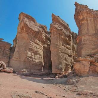
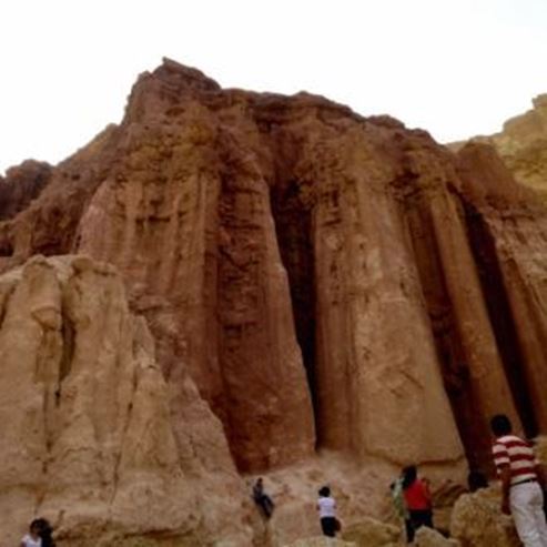
From the entrance to the parking lot, you will turn towards the northeast to the dunes following the red trail marking. On the light sand, you'll notice dark, heavy stones. These are pieces of iron in the light sandstone. Rocks that descended from the cliff formed natural stone statues. The trail continues through the channel and goes east. You will descend about 200 meters to a lonely rock island that stands in the middle of the wadi with a passage that is also suitable for children. The trail continues up the dune through the passage between the rocks to the hidden valley. From there you will continue into a wadi, and after a short walk, you will climb the branch and go down the next wadi to the 'Valley of the Palaces and the Shanty's."" From here you can continue the trail in two ways: the simple way makes its way to the right of the hill. Those looking for the challenge might prefer to go up the hill to the left and meet an incredible sandstone pillar. The trail continues into a field with unique traits. There are shafts; actually, holes dug to reach the copper deposits. Afterward they were blocked intentionally or by landslides, shallow cavities formed in which fine grain material accumulated. From here you will begin to descend in the wadi and then walk on its left side until you meet the black trail markings. You will continue to walk along the main channel of Nahal Timna until you meet the trail marked in Blue - Trail 6, with which you will take towards Boreg Hill and the vehicle waiting there for you.
Written by: Assaf Holzer
Photo: Doron Nisim
- Тип
- Піші прогулянки
- Регіон
- Ейлат
- Довжина
- 5 km
- Тривалість
- hours 4
- Рівень складності
- Середній
- Відправна точка
- Timna Park (карта)
- Кінцева точка
- Timna Park (карта)
- Карта
- Map no. 20
- Паркінг
- Паркінг
- Admission
- Плата за вхід
- Вода питна
- Вода питна
- Підходить для дітей
- Підходить для дітей
- Підходить для пікніка
- Підходить для пікніка
- Телефон
- +972-8-6616976
- Електронна пошта
- tayaroot@gmail.com
Подібні стежки
Цікаві місця поблизу

Розважальний центр та екстрим-парк «Top 94 - Extreme Park»
Поруч ресторани