Nabatian City Mamshit
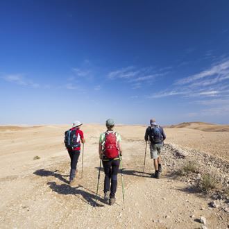
Visit to an archaeological site and the Mamshit stream course
The remains of the city of Mamshit have been declared by UNESCO as a World Heritage Site, and are on display in the Mamshit national park, while Nahal Mamshit is home to impressive Nabataean dams that were used to contain flood water. The Israel Nature and Parks Authority operates the Mamshit National Park Nabataean Khan campground at the site.
Main Points of Interest
Frescoes room
Mosaics
Horse stables
Dams
Scenic Lookouts:
The west tower and the balcony in the mounted-police station provide a beautiful lookout over the city ruins and Nahal Mamshit.
The Israel Nature and Parks Authority’s Actions to Improve Service to the Visitors and Preserve the Site:
The authority established a campground, erected signs and information points, marked the trail leading to the dams and to Nahal Mamshit, and recreated the ancient atmosphere in the “Nabataean Market” in the city streets during Chol HaMoed Sukkot and Passover. The Authority also restored ancient constructions, and is preserving the mosaics and the frescoes.
Getting to the Site
From Dimona drive east on highway 25, and after 7 km turn right towards the national park, following the signs.
Background
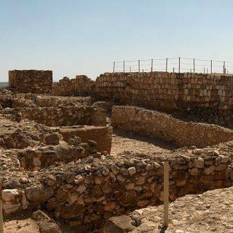
Mamshit is the Nabataean city mentioned in ancient sources as Memphis, and is also known by its Arabic name Kurnub. The city extends over 0.04 km²; it is the smallest among the Nabataean cities in the Negev, but is the most extensively restored among them. The city buildings are very grand, exhibiting unique architectural style not seen in any other Nabataean site. The city ceased to exist in the 6th century AD, but entire streets with large clusters of buildings are still standing – complete with halls, yards and balconies. The stones used in their construction are well chiseled, and the supporting arches are of the highest quality. The restoration work at the site enhances the visitors’ experience, revealing the unique qualities of the city.
The Trail Route
1. The Nabataean Town of Mamshit
The tour begins at the gate in the city wall. The gate and its stone ceiling, supported by two arches, are well-preserved. The city wall was built in two stages - a fence was built about as thick as a regular residential wall, and it was later thickened.
From here we proceed to Beit HaAmidim (“home of the wealthy”, the palace) – a three-story building, the most luxurious found in Mamshit. The house was built around a central yard; it also includes a large reception hall, which may indicate that it was the residence of the city governor. The yard is paved with stone plates, and it also serves as roof to the well underneath. Next to the house stands a tower, the lower courses of which are made of very large stones, with its top providing a lookout over the dams and Nahal Mamshit.
The next structure is called building XI (“the stable house”) – this also was an upscale home constructed to high standards, with the stable standing out in its luxurious style.
The St. Nilus Church (the west church) was built in the end of the 4th or the beginning of the 5th century AD, adjacent to the stable house, and partially on its premise. The church floor is a colorful mosaic incorporating geometric and floral patterns, and also includes five inscriptions in Greek – one of which reads: “God, save your servant Nilus, lover of Jesus, who founded this building. Preserve him and his household”.
The east church (Church of the Martyrs) is adjacent to the west one; for its construction Mamshit residents required a large area, and therefore destroyed part of the city wall. The church is styled as a basilica, with the floor of its nave paved with mosaic in simple geometric patterns. An indentation in the floor of the room north of the apse used to house a reliquary; a cross-shaped baptismal font also survived right by the church.
The police station was built by the British during the Mandate period at the highest point in Mamshit. During the 1930s the British took apart the city fortress, using its stones to build the station for the camel-mounted police. A lovely lookout over Nahal Mamshit is available from the open space east of the police station.
Our next stop is the market, which is a building consisting of three rows of rooms built along two streets, stretching from the north to the south. The fourth row is a shorter one, closing the north end of the building. During Chol HaMoed Sukkot and Passover, the Israel Nature and Parks Authority operates a “Nabataean Market” in the building.
Next to the market is the Nabato House – the largest private residence in Mamshit, extending over 2,000 m² (including the yards). The frescoes in the room named after them depict a scene from the “Cupid and Psyche” myth. In the residential wing of the house, 10,500 silver coins from the Roman period were discovered under a flight of stairs. The house was inhabited until the 4th century AD.
The public bath at Mamshit was built according to all the rules of Roman architecture, including the spacious vestibule and the benches along its walls. From there stairs descended towards two cold-water pools (frigidaria), one shaped as a half-circle, the other octagonal. From there bathers moved to the tepid room (tepidarium), and next to the hot one (caldarium). All the water for the bath came from the adjacent public reservoir.
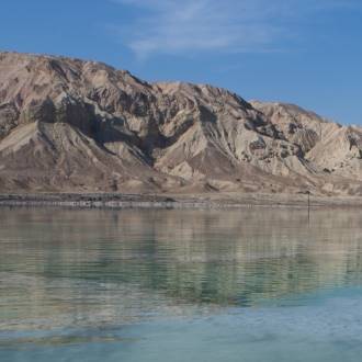
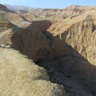
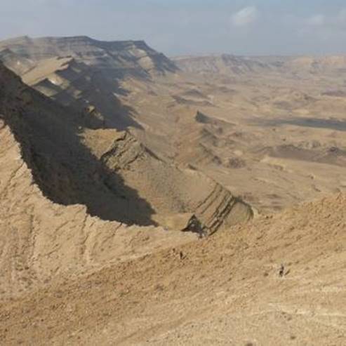
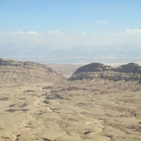
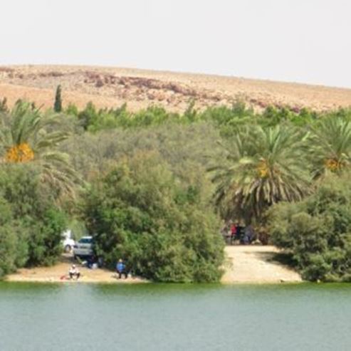
2. The Dams in Nahal Mamshit
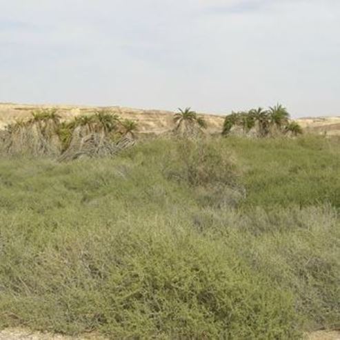
The Nabataean residents of Mamshit built a dam system in the Nahal Mamshit streambed in the 2nd century AD, to collect water for their agriculture terraces in the area; it was capable of collecting some 15 km³ of water. Now the dams are filled with sand and sediment.
Before the park gate, a trail marked red bends to the west (to the right for those coming from highway 25), and after about half a kilometer descends to the streambed of Nahal Mamshit – from there turn right (west), walking along the streambed to one of the Nabataean dams, whose height is partially concealed by sand and sediment.
To return, walk down the streambed to the east, and carefully climb down the rocky left bank. Here you will see a dam from the Mandate period used by the British mounted police, and built on the foundation of the Nabataean dam.
Here visitors may choose to end the tour and return the way they came, or continue along the gradually deepening streambed, reaching a well that was dug here during the Mandate period. There is a crossroads of trails next to the well, from which a trail marked green leads to the left towards the fence of the national park (while the trail marked red continues to highway 206).
The dams can also be reached from inside the park, using a trail leading to the British dam not far from the St. Nilus Church (the trail is marked in the park brochure).
Lodging in the Nabataean Khan
The khan offers a large tent for lodging and events (up to 150 people), 15 permanent tents (up to 8 people each), several open-air sleeping areas, and 4 rooms with amenities (5 beds in each). The tents are heated. The khan also offers a kitchen with refrigerators and cooking stations, as well as restrooms, showers with hot water, sheds, lighting, and cellphone-charging points. It is open year-round, subject to fees and reservations. For reservations call 08-6280404 (ext. 1), or email us at savit@npa.org.il.
- Type
- Hiking
- Region
- South
- Near to
- Yeroham
- Length
- About a kilometer in the site and about 2.5 kilometers in the Mamshit stream
- Duration
- About an hour at the site and two hours in Nahal Mamshit
- Recommended season
- Spring, Summer, Autumn, Winter
- Starting point
- Parking of the Mamshit National Park (map)
- Ending point
- At the starting point (map)
- Special equipment
- Hat, Shoes, Water
- Precautions
- Do not deviate from the marked trails, do not walk in a real stream during hot weather
- Parking
- Parking
- Drinkable water
- Drinkable water
- Suitable for children
- Suitable for children
- Picnic suitable
- Picnic suitable
- Phone
- +972-8-6556478
- mamshit@npa.org.il
Similar trails
Nearby attractions

Nearby restaurants