The Accessible Trail to the land of Tributaries
circular route
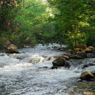
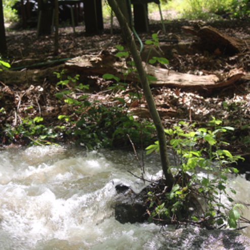
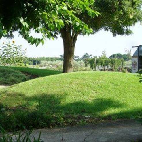
The Snir Stream is one of the Jordan River’s tributaries, and it sustains the mature forest along its banks and the rare vegetation associated with wetland habitats. The NPA has made the park accessible and offers everyone the opportunity to enjoy the world of nature and the rare view of the Hula Valley’s streams.
Main Points of Interest
The flowing stream and woods along the banks
Picnic area
Wading pool
Pool for rare aquatic plants
Observations Points
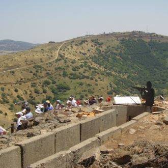
The bird observatory at the Tapline reservoir
Observation point of the Snir Stream
The National Parks Authority has made a wading pool for visitors to enjoy. The NPA does a great deal of preservation and maintenance work here: It has formed a pool that serves as a refuge for the rare aquatic plants that were once typical of the Hula Valley, such as yellow water-lilies and dwarf water clover (Marsilea minuta). It has renewed and restored the channel system that diverted the waters of the Dan Stream to the Snir Stream. It has built crossings for otters – rare mammals in Israel – underneath road bridges, and it maintains the fern population, preventing invasive plants from restricting the growth of the rare large horsetail ferns. The NPA also monitors other invasive plants that could dominate the reserve area, mainly after fires (the reserve is vulnerable to fires, due to the many tourists and the close proximity to the Lebanese border.)
How to Get There
Drive from the Metsudot Junction in Kiryat Shmona, in the direction of Mount Hermon (Highway 99). Turn north after 4.5 km at the Hagoshrim Junction and follow the signs to the reserve parking area.
Background
The Snir Stream flows in the north of the Hula Valley to the foot of Mount Hermon. It is 60 km long, mostly within Lebanon, and it is the longest of the Jordan’s tributaries. The stream begins by the town of Hatsbaya, hence the Arab name of the river – the Hatsbani. The Hebrew Name, Snir, is one of the names for Mount Hermon. Other, stronger springs are the Wazani springs at the foot of the village Ghajar. In the summer, the farmers in Lebanon draw water from the Hatsbani springs, but most of the spring water from Wazani flows to Israel, and today, water is also diverted to the Snir Stream from the Dan Stream. The NPA has restored part of the Nokhila channel and restored the link between Nokhila Valley springs and the Dan Stream.
The road from Damascus to the Lebanese coast passed by the Snir Stream between Mount Hermon and the Hula swamps. The Ghajar bridge over it served as a landmark determining the border between the British Mandate in Israel and the French Mandate in Syria and Lebanon.
Flora and Fauna
Riverside forest grows along the banks of the stream, including oriental plane trees and brook willows, alongside wetland vegetation such as common reed, common giant reed (Spanish cane), purple loosestrife, pale persicaria and watercress. Rare plant species that grow around the Snir Stream include horsetail fern, Stachys spectabilis, and milk broom, which reaches its distribution limit in the south with the Snir Stream.
Growing further away from the water, we have the Mount Tabor oak, interspersed with jujube. These trees create a kind of “forest park” with large spaces between the trees, thus allowing an abundance of colorful seasonal flowers to bloom here in the winter and spring.
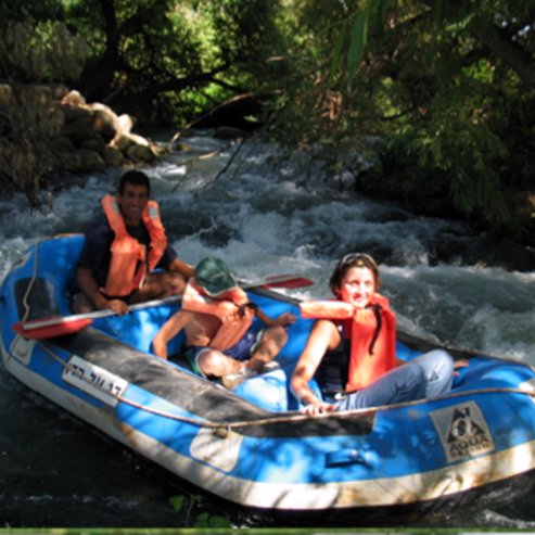
The nature reserve’s wildlife includes the otter, a small predator of the Mustelidae family that is in danger of extinction. The otter feeds mainly on fish, and in order to improve their chances of survival, the NPA has made “otter crossings” under the bridges of roads in the vicinity of the reserve, allowing the otters to move between the different sections of the stream, even when the current is very strong. Other noteworthy animals in the reserve include wild boar, porcupines, mongooses and badgers. The Tapline reservoir offers a winter home for many water birds, which nest in the Tapline’s walls in the quieter parts of the reserve. Many invertebrates also live in the reserve, including river crabs, dragonflies, damselflies, primitive crustaceans and water insects. Bathing for visitors in the reserve’s waters harms the wildlife’s activities and as such is permitted only in the wading pool.
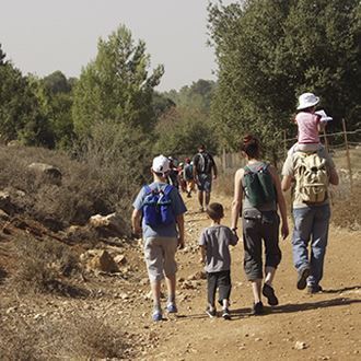
The Trail
The Accessible Trail
Trail type: A circular trail that takes about half an hour to complete (not including time splashing in the wading pool).
From the parking area, the trail follows along a channel with aquatic plants that bloom in the summer. The trail crosses one of the Dan Stream tributaries and goes down to the wading pool and its waterfall. It is a great place to freshen up with a cold shower in the summer. Nearby, there is another pool where rare yellow water-lilies grow. The trail arrives at a special observation point that looks over the Snir Stream in all its glory. From here, the trail returns to the wading pool and to the exit point.
Other Trails in the Reserve:
The Mid-Level Trail
Trail type: a circular trail suitable for families that takes about half an hour to complete. The trail includes climbing rock stairs and boulders and hikers cannot avoid getting their feet wet.
From the parking area, walk to the wading pool, as described for the accessible trail. From the pool, follow the signs to the stream. Stairs lead to the intersection between the northern Dan-Snir channel and the Snir Stream. The temperature of the water in the Dan channel in the summer is much lower than that of the Snir Stream.
Parts of the trail along the riverbank are shaded by riverbank vegetation, oriental plane trees and white willow. The trail passes several waterfalls that feed the Snir Stream. After ten minutes, climb left up the stairs and continue along the trail to the exit point.
The Long Trail
Follow the mid-level trail, but instead of climbing the stairs to return to the parking area, continue downstream along the Israel National Trail, until you reach the ledge built of travertine (“the Cascade”). This is a good place to rest and enjoy watching the flowing water. The trail continues along the water shaded by riverside trees, until the end of the trail. From here, you can return to the Snir Stream parking area (about 15 minutes).
New: The Bird Observatory and the Tapline Reservoir
The walk to the reservoir takes about fifteen minutes (the path is not accessible).
Near the Nokhila channel, which leads from Ein Bared north of Tel Dan, the Tapline pipeline runs. This is the Trans Arabian Pipeline that carried oil from the oil fields of Saudi Arabia to the port of Sidon in Lebanon. The pipeline goes through the Golan Heights. In 1969, there was an explosion on the pipeline, and crude oil leaked into the Dan Stream and from there to the Jordan River. Following this act of sabotage, safety measures were taken: The waters of Ein Bared were diverted from the Dan Stream to the Snir Stream, and the reservoir was excavated. The reservoir makes it possible to divert the oil and prevent the contamination of the Jordan River tributaries. The reservoir attracts many water birds such as mallards, coots, teals, little grebes, ibises, herons, storks and more. These can be watched from the hidden observatory constructed for the convenience of visitors.
About a ten-minute walk from the observatory, there is an observation point overlooking the spectacular view of the Snir River, Mount Hermon, the Golan Heights, and the hills of southern Lebanon and the Galilee.
- Type
- Hiking
- Region
- North
- Near to
- Tiberias
- Length
- 1 Km
- Duration
- One to two hours
- Recommended season
- Spring, Summer, Autumn, Winter
- Starting point
- The Nahal Snir Nature Reserve (map)
- Ending point
- Nahal Snir (map)
- Special equipment
- Water walking shoes, bathing suit
- Precautions
- Do not stray from the path, entry into the water is allowed only in splash pool
- Parking
- Parking
- Accessibility
- Accessible
- Circular
- Circular
- Drinkable water
- Drinkable water
- Bathing water
- Bathing water
- Suitable for children
- Suitable for children
- Picnic suitable
- Picnic suitable
- Phone
- +972-4-6950064
Similar trails
Accessible route between charming rivulets


Nearby attractions


Nearby restaurants


Mcdonalds- North Park, Maayan Baruch

Rebar- Gan Hatzafon, Gan Hatzafon compound