From Shaharut to Yotvata
One Way
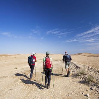
The trails from the cliffs by Shaharut to Yotvata in the Arava reveals prehistoric sites, desert landscapes and remains from the Roman fortress at Yotvata. The NPA has installed metal ladders and safety cables in steep places.
Main Points of Interest
Desert vegetation
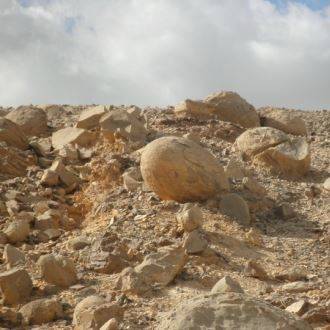
Prehistoric cairns
Remains of an ancient bathhouse
Remains of a Roman fortress
Observation Point
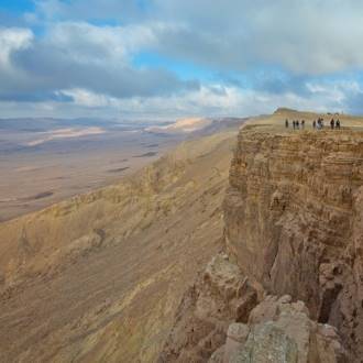
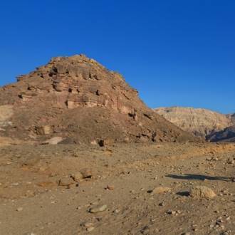
There is a spectacular view of the Arava Desert and Edom Mountains from the top of the cliff by Shaharut
NPA Activities to Improve Services to Visitors and to Conserve the Site
The NPA has allocated an area for campgrounds, marked the trail and installed metal ladders and safety cables in steep places.
How to Get to Shaharut
From Highway 12, turn toward Shaharut. After about 6.5 km, you arrive at a road that goes up to the resort village being built at Khan Shaharut. The entrance to the trail is 300 meters from there, marked with blue trail marks, right in front of the sign to the Israel National Trail.
How to Get to Yotvata
Turn west from Highway 90 to Yotvata. You can wait for the hikers on the old Arava road or continue to the Yotvata Fortress by following the blue trail marks.
Background
Back in the 6th millennium BCE, there was a network of roads in the Negev. Along the way, places of worship and to sleep were established, and over the generations, they changed from observation structures to strongholds and to fortresses. The new trail going down from Shaharut to Yotvata passes by an ancient site and ends at a fortress from the Roman period.
Trail
To the Row of Crenellations
The trail passes between the hill where the holiday village is being built and the communal settlement Shaharut. After approximately 700 meters, we get to the top of the cliff. The view is wonderful. The Arava settlements lie at the foot of the cliff – Yotvata, Grofit and Ketura – with the Edom Mountains opposite.
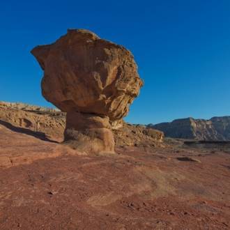
The difference in altitude from the beginning to the end of the trail is 450 meters. Here, in the steep section, the trail overcomes the height difference with several sharp bends. Stop after 400 meters at the bend by the big rock with a trail mark to turn left. The view of the small protrusion at the foot of this point is stunning. Unlike the general view sloping downward to the east, this protrusion rises. On top of the protrusion there is a prominent row of cairns. Uzi Avner, the archeologist who studied the Uvda Valley and the surrounding area, calls this row of cairns a row of crenellations.
Rows of crenellations have been found at the top of many hills in the Negev and Sinai. Similar rows were discovered in the Sinai Desert, in Transjordan and in Arabia. The crenellations were probably used for pilgrimage, indicated by the paths that lead to them. They may also mark burial sites of important people or sacred sites. They were built on ancient roads so that the people taking those roads could stop and worship.
Ladders and Gorges
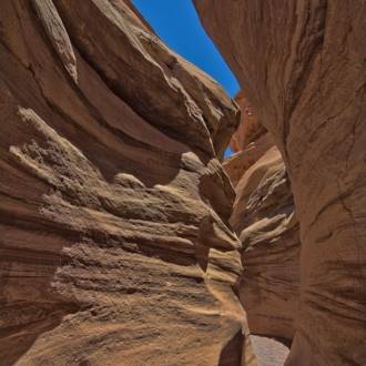
After passing the row of crenellations, the trail enters a narrow gorge with a small acacia tree. From here, we walk between gray clay walls decorated with thin strips of white plaster. Here and there, we see big chunks of light-colored rock built like polygon columns. The scratches you can make in the rocks using a fingernail indicate that they are made of plaster.
The trail comes out of the gorge, leaves the channel and climbs up a moderate slope. It then turns down and joins a dirt road going up from Yotvata to Shaharut (with green trail marks). We continue right, following the blue trail marks. At first, we walk through a wide channel, but we soon get to a rock waterfall. In front of it, a green, fresh twisted acacia peeps out. We now go down the channel with the help of metal ladders and a safety cable set in the stream.
The path gives way to the next waterfall. It goes widely around it from the right and enters another narrow gorge with walls of very cracked limestone, at the end of which is another waterfall. But our adventures are not over yet. We enter another beautiful gorge, with a surprise waiting for us: a huge twisted acacia hanging from a height of 7 meters, its end almost reaching the riverbed. There are a few acacia trees growing at the end of the gorge, and they are scattered along the way to the campgrounds at Ma’aleh Shaharut (meeting the green trail).
Observation Point over Yotvata
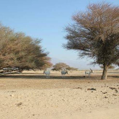
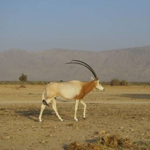
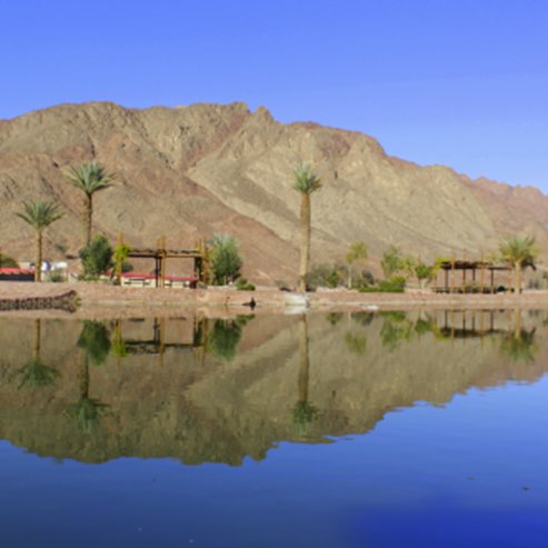
The trail crosses the wide channel of one the Nahal Shaharut tributaries and climbs the low ridge separating the Negev Mountains from the Arava Desert. The section along the top of the ridge is almost 2 km long. Here, about 120 meters above Yotvata and the Arava, there is an observation point overlooking the magnificent acacia savanna. There is a good view of the Yotvata Fortress through the trees, and after Highway 90, we see the expanses of the Hai-Bar Yotvata Nature Reserve where the NPA protects endangered animal species.
From the Yotvata Side
The trail descends to an electric pylon. The hill to the left towers above the Arava plain and two large cairns are noticeable. Yotvata was a big oasis and people made their permanent residence here during the Chalcolithic period (4th millennium BCE). Humankind left behind many remains of settlements, and the trail passes through the remains of the two most prominent structures: To the right, there is the Roman fortress, and to the left, there are the remains of the fortress bathhouse. Close to the fortress, there is a small stone building. It was built in the 1930s as a temporary police station during the British Mandate.
The Roman fortress was a square (40x40m) fortified compound with four corner towers. The wall was built of stone to a height of 1.5 meters with a layer of bricks above. Coin findings indicate that the fortress fulfilled its object from the last quarter of the 3rd century CE until the 4th century CE. The official inscription on the gate lintel says that the fortress was built during the reign of Emperor Diocletian, and thus was probably a limes (border) fortress of the kingdom at that time. The bathhouse probably served the inhabitants of the fortress.
The End of the Trail
For those who arrange a car to collect them at the fortress, the trail ends here. The rest continue to follow the blue trail marks to the military camp south of Kibbutz Yotvata. A pedestrian promenade was recently paved from the camp. Walk along the promenade for 700 meters to the Yotvata Inn. By the side of the road there are bus stops. From here, you can take a bus north or to Eilat.
- Type
- Hiking
- Region
- Eilat
- Length
- 8-10 Km
- Duration
- 5 - 4 Hours
- Recommended season
- Spring, Autumn, Winter
- Starting point
- Shaharut (map)
- Ending point
- Yotvata (map)
- Special equipment
- Shoes, hat, water, food
- Precautions
- Do not deviate from the marked path
- Parking
- Parking
- Suitable for children
- Suitable for children
- Phone
- +972-8-6373057
- Fax
- +972-8-6326172
- haibar-yotvata@npa.org.il
Similar trails
Nearby attractions