Khirbet Qeiyafa - Elah Fortress
Circular route
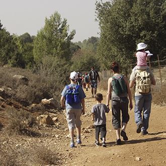
From Netiv HaLamed-He to Hirbet Kaifeh
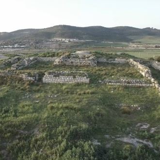
The trail follows the northern bank of Nahal HaElah, reaching the Hirbet Kaifeh archaeological site – where remains were discovered of a fortress dating to the Iron Age and to the ancient Israelite period, and which archaeologists identify as the site of the biblical city of Shaaraim. The Israel Nature and Parks Authority works towards designating the site as a national park.
Main Points of Interest:
An archaeological site from the Iron Age
The story of David and Goliath
Ana trees
Nature reserve, ana trees, the Elah Valley
The Elah Valley and the hills around Beit Shemesh – an important wildlife crossing between the Coastal Plain and the Judaean Mountains
Scenic Lookouts
A lookout at Hirbet Kaifeh provides a view over the Elah Valley, Tel Azekah and the Coastal Plain, as well as over Mount Hebron.
The Israel Nature and Parks Authority’s Actions to Preserve the Site
The Authority works towards prevention of additional construction in Ramat Beit Shemesh, in order to preserve the wildlife crossing between the Coastal Plain in the west and the Judaean Mountains in the east; as well as towards designation of 4 km² in the Nahal Elah area and the hills around Beit Shemesh as a national park.
Getting to Netiv HaLamed-He
Before the entrance to kibbutz Netiv HaLamed-He turn left (west) towards the road that follows the fence surrounding the community. The road bends to the right, reaching the “Tami 4” factory parking lot, where you can leave your car.
Background
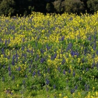
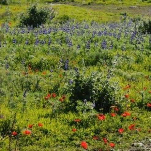
The hills of the Shfela south of Beit Shemesh, above the northern bank of Nahal HaElah, rise to about 400 meters above sea level. This area is characterized by dwarf-shrub type of vegetation, with remains of Mediterranean woodland and fruit trees of abandoned gardens. The area is relatively extensive, and is home to large mammals such as mountain gazelles, golden jackals, red foxes, porcupines, and many species of birds. During winter and spring the area is in colorful bloom.
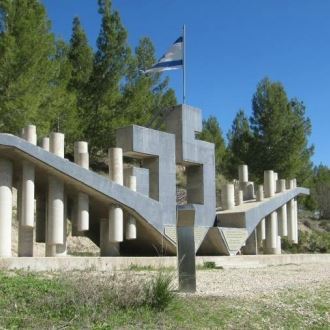
There are many historical sites here, including from biblical times – among them Tel Yarmuth and the site of David's battle with Goliath. Additionally, remains from the Second Temple period were found among the Beit Nattif ruins. Also, during the War of Independence, the Convoy of 35 (“Lamed He” – 35) marched nearby in an attempt to break the blockade imposed on Gush Etzion by the Arab Legion.
The Israel National Trail crosses the national park. You can walk to the Adullam-France Park to the south from here, to Tel Azekah and Britannia Park to the west, and to Bar Giora and Nahal Ktalav to the east.
The Trail Route
1. Netiv HaLamed-He
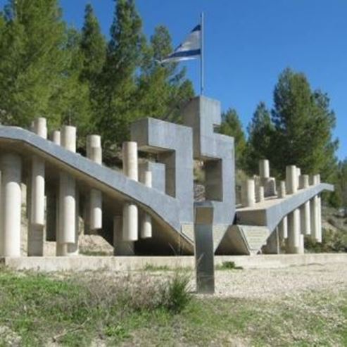
Kibbutz Netiv HaLamed-He is named after the Palmach platoon that passed here during the War of Independence on its way to Gush Etzion – all 35 members of which were killed in one battle. The kibbutz was established in 1949 on the site of the abandoned Beit Nattif village.
The trail route ascends north from the parking lot, and after half a kilometer meets the Israel National Trail onto which we will turn left (west).
2. The Israel National Trail
The Israel National Trail provides a scenic view over the Elah Valley, as it stretches from Tel Azekah to Tel Sokho, and is identified as the site of the battle of David and Goliath. This is one of the most beautiful Mediterranean woodlands in Israel, with its predominant species being the Palestine oak and the mastic tree. The open dwarf-shrub areas include such typical plants as the sarcopoterium, the azarole, the black hawthorn, the spiny broom, and the terebinth. Hikers are likely to encounter piles of dung left by gazelles – these serve as territory markers for the males, and their odor provides the animals with information about other gazelles nearby.
Walk another 1.5 km along the Israel National Trail, leaving it at the point where it bends to the right (north) – keep walking straight onto a dirt road leading to Hirbet Kaifeh, which is clearly visible on the right. The trail climbs up to the top of the ruin along a marked path, and care must be taken not to stray from it.
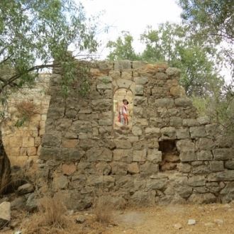
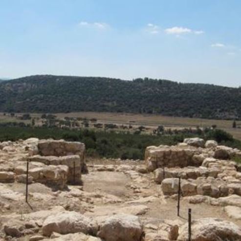
3. Hirbet Kaifeh
The Hirbet Kaifeh ruin stands on a route leading from the Coastal Plain to Hebron and to Jerusalem, having at the time served as the western gateway to the Kingdom of Judah. Excavations conducted here in 2007 by the archaeologist Prof. Yosef Garfinkel from the Hebrew University and Saar Ganor from the Antiquities Authority, revealed the remains of a fortified city surrounded by a casemate wall. The wall was built at the end of the 11th century BC, of megaliths each weighing four tons and more. Two gates were discovered in the wall, one on the western side of the city – it has been partially recreated - the other on the south-east. The site was settled briefly during the Iron Age, and was resettled later, during the Hellenistic period. No Philistine pottery has been found here.
A 16.5x15-cm ostracon (an inscription-bearing piece of pottery) was found at the site. The inscription was made in ink, consisting of five left-to-right lines in Hebrew written in Proto-Canaanite alphabet. The archaeologist excavating the site and other scholars think that this is the earliest Hebrew inscription ever found – dating it to the 10th century BC at the latest. The inscription is fragmented, and apparently discusses social commandments.
This was the first time a biblical city was discovered in Israel with exactly two gates in its wall – leading scholars to hypothesize that the Hirbet Kaifeh ruin was the site of the biblical city of Shaaraim (“two gates”), mentioned in the first Book of Joshua as neighboring the Elah Valley, and the cities of Sokho and Azekah (“...Jarmuth, Adullam, Sokoh, Azekah, Shaaraim...” – chapter 15, verses 35-36). Shaaraim is also mentioned in the description of the battle between David and Goliath. After David killed Goliath in the Elah Valley, the Philistines retreated through the valley: "Then the men of Israel and Judah surged forward with a shout and pursued the Philistines to the entrance of Gath and to the gates of Ekron. Their dead were strewn along the Shaaraim road to Gath and Ekron." (Book of Samuel 1, chapter 17, verse 52).
4. The Ana Tree
A dirt road leads south from Hirbet Kaifeh to the valley created by Nahal HaElah. The entire valley is cultivated, covered mostly by vineyards and almond orchards – only the stream channel is decorated with ana trees, well visible from the dirt road leading east to the kibbutz parking lot. The road passes through an almond orchard at the foot of the hills to the north. The small eucalyptus grove is a good spot for a short break before reaching the end of the trail.
In the past the valley was covered by a thicket of ana trees, which is a thorny medium-sized tree characteristic of the relatively humid savannas of eastern and western Africa. It also has some concentrations along the Coastal Plain, in the streams of the Judaean foothills, and in the valleys of Israel’s northern district. Ana trees growing in Israel almost never seed – instead, they reproduce through offshoots of their roots, and this is why they create thickets everywhere they grow. Most of the ana trees in the valley have been cut down to make room for agricultural land, and the only ones remaining are the beautiful specimens growing along the riverbanks (where it is inconvenient to cultivate the land), serving as a reminder of times past.
Photos :Yaels (http://creativecommons.org/licenses/by-sa/3.0) via Wikimedia Commons
- Type
- Hiking
- Region
- Jerusalem Area
- Near to
- Jerusalem
- Length
- 5 Km
- Duration
- 3 Hours
- Recommended season
- Spring, Summer, Autumn, Winter
- Starting point
- Netiv HaLamed-Heh, Judean Foothills (map)
- Ending point
- Hurbat Kiapa, Judean Foothills (map)
- Special equipment
- Shoes, hat, water, binoculars
- Precautions
- Walk only on marked trails or dirt roads wide
- Parking
- Parking
- Picnic suitable
- Picnic suitable
Similar trails
A new light shines in the Stalactite Cave
Nearby attractions


Nearby restaurants