The Squill Trail at Tel Afek
A short walk and recreation in the park and the antiquities site

The Tel Afek area in the Yarkon National Park is a leisure park at the heart of nature which also has remains from the Roman, Ottoman and British Mandate periods, as well as a spectacular view over Gush Dan. The Squill Trail links between the park's sites. The Israel Nature and Parks Authority has built a lake in the park and restored the winter pool, and these are a haven for a unique world of flora and fauna.
Main points of interest:
The Binar Bashi fortress
Remains of the Roman city of Antipatris
Artificial lake
Winter pool
Mandate-era water system
Leisure site at the heart of nature
Viewpoints
The Binar Bashi fortress has a spectacular viewpoint over Gush Dan
Israel Nature and Parks Authority activities to improve visitor services and preserve the site
The Authority has set up a leisure and holiday site at the heart of nature, and has built a winter pool. Through its excavations, the Authority has uncovered the remains of Antripatris and it preserves there, as well as preserving the Ottoman fortress of Binar Bashi.
How to get here:
From Rosh HaAyin take Route 483 towards Petah Tikva, and after about 1.2 km turn right and follow signs to the National Park. Continue for another 500 m and turn left into the National Park.
Background
The Yarkon-Afek National Park spreads over 13,000 dunams, from Tel Afek to the Morasha interchange. There are two areas within the National Park: Tel Afek and the Yarkon source. The Squill Trail goes between the important natural and historical sites in the park, and it is named for the many squills that grow along it.
Today Tel Afek spreads over 120 dunams, but the waters of the Yarkon have gradually reduced parts of it, so we can assume that in the past it was bigger. The peak of the hill rises to 36 m above sea level, around 15 m above its surroundings. In ancient times the site was strategically significant, since it commanded a view of an important section of the international route from Egypt to Damascus. The road bypassed the swamps to the east and went past the city of Afek.
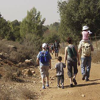
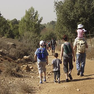
Trip route
1. The eucalyptus grove
The eucalyptus grove and the large car park in the shade of the trees are pleasant places to get ready for your trip and eat a light meal.
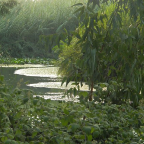
2. The winter pool
The winter pool is a natural reservoir, which fills up with rainwater in the winter and dries out in the summer. This is a unique habitat with a huge difference between winter and summer, and as such contains plants and wildlife which have adapted to these conditions. The pool is a breeding ground for species of amphibians such as the Middle East tree frog, the green toad and the southern banded newt. In the past there were thousands of seasonal pools in Israel, but most of these have disappeared as the country has developed.
3. The theatre and the cardo
The small theatre discovered at the site has been host to conferences and musical shows. It was built in the Late Roman Period (4th century AD) and was probably never finished. Researchers assume that the building was damaged in an earthquake.
From the slope of the theatre you can see the Afek passage, between the springs of the Yarkon and the hills of Samaria. In the past the international road from Egypt to Syria ran through here, and as such it was a strategic asset, and there were fierce battles between Israel and the Philistines to gain control of it.
Go north from the theatre along the cardo - the main street which crossed the city from north to south in the Roman period. This was the commercial quarter of the city of Antipatris, which was probably destroyed in a fire in the year 70 AD. The cardo was 8 m wide. At its centre a smooth stone floor has been uncovered, and on either side there were shops and workshops.
Paul slept in Antipatris on his way from Jerusalem to Caesarea, before he was sent for trial in Rome.
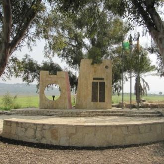
4. The Alexandroni memorial
A narrow path leads from the cardo to a modest monument in memory of fighters from the Alexandroni Brigade and the Irgun who fell in this area in the War of Independence.
Iraqi forces took over the hill and shelled Petah Tikva and Rosh HaAyin from here.
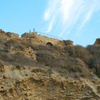
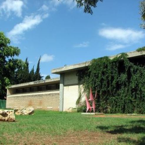
5. The Binar Bashi fortress
The building which stands out most to this day is a remnant from the Ottoman period at the top of the hill: the Binar Bashi fortress (Rosh HaAyin in Turkish), which was built in 1571. The fortress is a square and covers an area of 8,000 m2. Each corner has a square tower, except the south-western tower, which is octagonal. The gate of the fortress is based on the remains of the ancient stairwell of the palace of the Egyptian ruler.
6. The house of the Egyptian ruler.
Evidence has been discovered at Afek which indicates that the site has been settled since the Chalcolithic Period (4500-3300 BC). The city was also continuously inhabited in later times, and prospered greatly during the Middle Bronze Age (2000-1550 BC). Excavations have uncovered the remains of buildings and rulers’ houses. The palace of the Egyptian ruler from the Late Bronze Age (1550-1200 BC) is the most intact of the palaces at Afek, and as such has been preserved and partially reconstructed. It is around 400 m2 and looks like it was used as a fortified structure for the ruler and his guards. The ground floor is built from stone walls, and the floor above this is made from bricks. Many certificates and inscriptions were discovered in the ruins of the upper floor - a rare archaeological finding from the biblical period.
7. Natan Yonatan viewpoint
The viewpoint is located at the western gate of the Ottoman fortress, and it looks out over Gush Dan. The viewpoint commemorates the poet Natan Yonatan, stemming from his well-known poem That Man, which tells the story of a man who builds his house next to the stream.
8. The mandate-era water system
At the start of the British Mandate period the population of Jerusalem grew, and in the summer its residents suffered from a serious water shortage. The British decided to bring water from springs from Rosh HaAyin to Jerusalem, and in 1934 they began work. The pumping facility had two pumps (one as a backup). The water was pumped into a sophisticated system of concrete pools, and in these it was cleaned through a process of removing impurities and filtration. This water pipe only took about 2% of the annual water supply from the springs of the Yarkon. The water system can be seen easily from the east of the Ottoman fortress.
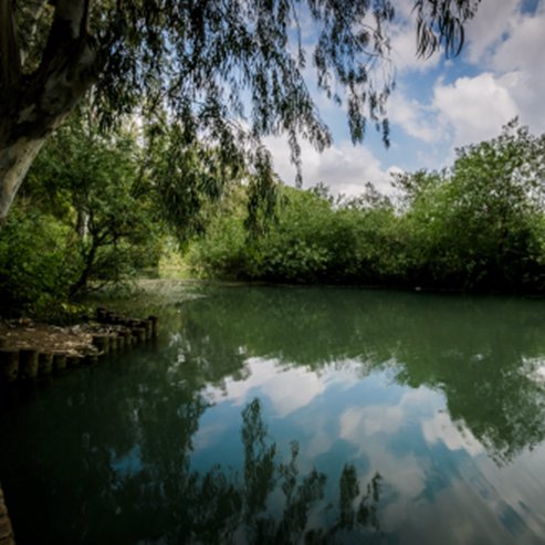
9. The lake
The large lake at the centre of the park creates a wet habitat, where riverbank plants such as the purple loosestrife, common reed and lesser bulrush thrive, as well as submerged plants such as longleaf pondweed. The lake draws in many species of water birds, including the mallard, Egyptian goose, moorhen and night heron.
- Type
- Hiking
- Region
- Tel Aviv & Center
- Locality
- Tel Aviv Jaffa
- Length
- 3KM
- Duration
- About an hour
- Recommended season
- Spring, Summer, Autumn, Winter
- Starting point
- The Yarkon-Afek National Park (map)
- Ending point
- The Yarkon-Afek National Park (map)
- Special equipment
- Shoes, hat, water
- Precautions
- Do not enter the lake or the Yarkon River
- Parking
- Parking
- Accessibility
- Accessible
- Circular
- Circular
- Drinkable water
- Drinkable water
- Suitable for children
- Suitable for children
- Picnic suitable
- Picnic suitable
- Phone
- +972-3-9030760
- Fax
- +972-3-9030760
Similar trails
The Boxthorn Trail and the Rampart Trail
Nearby attractions
The Yarkon Springs Site

Nearby restaurants