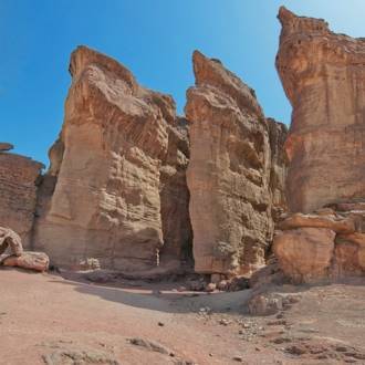
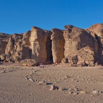
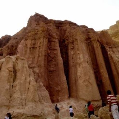
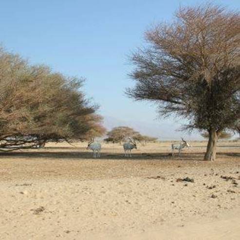
The Sculpture Garden on the cliffs of the Pillars of Solomon at Timna Park
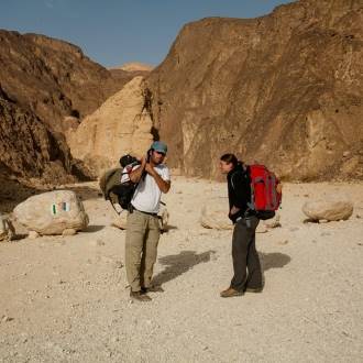
Families, hikers
Trail Color Marker: blue
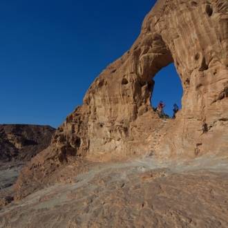
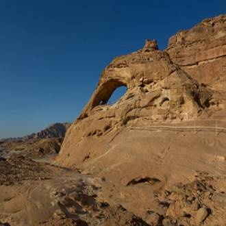
From the road, you will follow the blue trail marker eastward up the channel. At the beginning of the trail in the wadi are archaeological remains from about 3200 years ago, from the period of Egyptian activity in Timna. At the end of the ascent from the ravine, you will reach a dark, flat secluded valley. The marker will lead you to the right and west through a topographic saddle, followed by a left turn south to the level above Solomon's Pillars. From here there is a spectacular view to the southern Jordan Valley and the lake area. Solomon's Pillars are on the cliff below you.
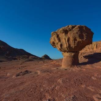
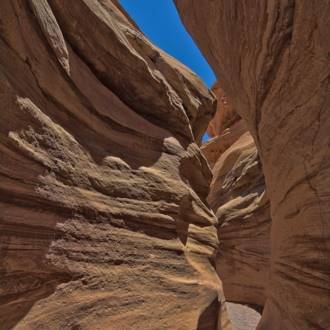
The pillars are actually rock columns attached to the wall of the cliff and separated from each other by spaces - narrow channels that developed from vertical cracks in the wall of the cliff. The columns are named after King Solomon, which was once attributed to his ancient mining activity in Timna. Archaeological research in the Jordan Valley shows that most of the mining activity took place in two periods: the earliest some 3,200 years ago by Egyptians, and the later during Edomite activity 3,000 years ago - during Solomon's reign in Jerusalem. At the foot of Solomon's Pillars, a temple that served as the miners was discovered, revealing numerous finds from that period.
From here you will continue with the marked path on the eastern side of the slope, above the cliff. You will descend on a rocky ridge to the ravine and exit to a road descending from the north. Here you will meet with black trail marker and turn right onto a dirt road that will lead you to the miners' temple and Solomon's Pillars.
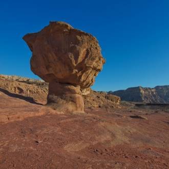
Trail extension: the circular route - through the granite quarry at the intersection of the paths with the blue trail marker (with which you descended) to the black, trail marker. Turn left with the black marker. The trail rises with a dirt road that reaches the top of the hill and the old granite quarry there. Around you are large boulders that were removed from the mountain and were used to build the port of Eilat and the marina.
From the quarry, there is a spectacular view to the north and west of the Timna Valley, the cliffs surrounding, and of Mt. Berekh in the west. From here you will descend with the slightly steep trail following the black marker until reaching the road. At the junction with the road, you turn left about 500 meters until you reach your vehicle.
Written by: Assaf Holzer
Photo: Dafna Tal for the Israeli Ministry of Tourism
- 类型
- 远足
- 地区
- 埃拉特
- 长度
- 3 km
- 持续时间
- hours 2
- 难度级别
- 中等
- 初始点
- Timna Park (地图)
- 结束点
- Shlomo columns, Timna Park (地图)
- 地图
- Map no. 20
- 停车处
- 停车处
- Admission
- 入场费
- 饮用水
- 饮用水
- 适合儿童
- 适合儿童
- 适合野餐
- 适合野餐
- 电话
- +972-8-6616976
- 电子邮件
- tayaroot@gmail.com
类似路线
附近的景点

附近的餐馆