The Cave Fortress and the Arbel Cliff
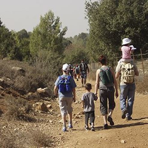
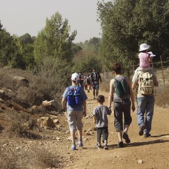
Landscape and ancient, circular route
A cliff overlooking the Sea of Galilee and the Golan Heights; an ancient settlement, including the ruins of
a magnificent synagogue; hiking trails reaching the cave fortress nestled in the cliff crevices – all await
you in the Arbel national park and nature reserve. Recently the Israel Nature and Parks Authority
restored the lintel above the entrance to the ancient synagogue, and is currently working on the
preservation of the cave fortress.
Main Points of Interest:
A trail leading to the cave fortress, which includes a challenging climb up a stake ladder
Cliff vegetation
The cave fortress
The Arbel cliff
A bird-watchers’ trail for the whole family
Scenic Lookouts
At the top of the Arbel cliff there is a bird-watchers’ trail leading to three scenic lookouts
The Nature and Parks Authority’s Actions to Improve Service to the Visitors and Preserve the Site
The Authority established a parking lot, built public restrooms, marked a scenic trail for the whole family,
and preserved and restored the cave fortress, as well as parts of the ancient synagogue.
Getting to the National Park
From the Kfar Hittim Junction on highway 77 (the road leading from Tiberias to the Golani Interchange)
take highway 7717, and from there proceed to moshav Arbel. Just before the entrance to the moshav
turn left, circling the moshav around its left side. After 1.1 km you will reach the Arbel ruins and the
synagogue, and, after additional 2 km, the National Park.
Background
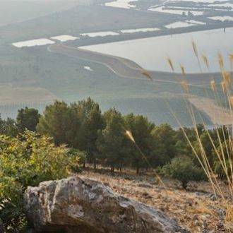
The Arbel nature reserve is part of the Arbel plateau – a basalt high plane in the Lower Galilee region. It
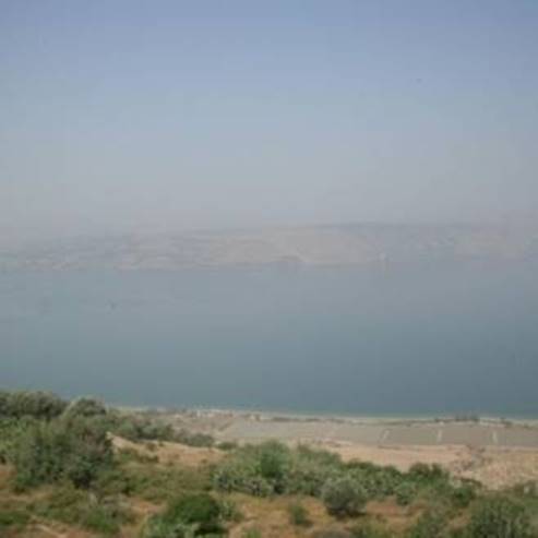
gradually rises eastward, ending in a massive limestone and dolomite cliff, overlooking the plain of
Ginosar and the Sea of Galilee.
The reserve contains several rare varieties of flowering plants, such as the Eastern hyacinth (in bloom
during December) and the Sharon tulip (in bloom at the end of February and in March), as well as
unique varieties of cliff plants – among them centaureas, rosularias, and dianthuses. From December to
February, the reserve may be visited by a wallcreeper. The wallcreeper is a rare bird, its general color is
gray to black, but when it spreads its wings, they reveal bright white and red colors.
North of the Arbel stands Mount Nittai, with an impressive cliff of its own, rising to 98 meters above sea
level. Mount Nittai is included in the Arbel reserve, but it is off-limits to visitors.
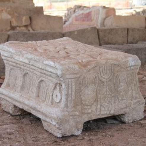
The Ancient Synagogue
The scholar Edward Robinson discovered the ruins of this magnificent synagogue in 1852, and since
then the site has undergone several excavations. The architectural style and the findings at the site led
researchers to assume that the synagogue was built in the 4th century AD, and was active until the 8th
century.
In its early period it had a hall with three rows of columns, together creating an incomplete (three-sided)
quadrilateral. The columns supported the galleries above, and benches lined the walls. The eastern part
of the northern wall had a compartment carved into it, with a small door – possibly used for collecting
donations.
It seems that the original building was demolished at an unknown time, and a newer synagogue was
erected in its place, apparently in the 6th century AD. The remains currently at the site are of the newer
synagogue. The newer synagogue was very different from the previous one, but the builders used many
items from the old synagogue when they erected the newer one. The main changes made were the
addition of a rounded niche in the southern wall that was intended for the Torah Ark and a Torah-
reading platform, a restored stone floor and an additional entrance in the northern wall, which possibly
was part of an additional facade for the building. The yard was expanded to the north, resting on two
long halls with arched ceilings.
Apparently the synagogue perished in a fire, possibly due to the big earthquake of 749 that damaged
many communities adjacent to the Great Rift Valley. The earthquake is traditionally known as the
Earthquake of the Sabbatical Year, because of the timing of its occurrence. Recently the Israel Nature
and Parks Authority recreated the main entrance to the building from its original parts that were strewn
about the site, and it now adorns the site in its entirety.
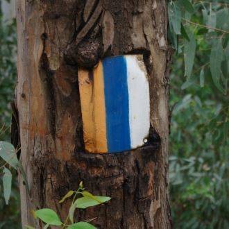
The Trail Route
1. The Carob Lookout
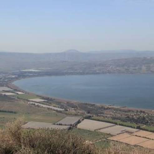
From the site entrance follow the black markings towards the Carob lookout, named after the Carob tree
on the edge of the cliff. The lookout reveals one of the most beautiful vistas in Israel: the Sea of Galilee,
the Golan Heights, Mount Hermon, and the eastern parts of the Upper and Lower Galilee.
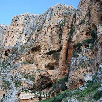
2. The Cave Fortress
The path then turns east, descending down a steep slope. The stakes installed by the Israel Nature and
Parks Authority are very helpful during the descent. The path descends towards the foot of the
mountain, and bends west. After some 800 meters the black-marked path meets another one, marked
red. Turn left up the red path, which will lead you to a large cluster of grottos, with enormous walls in
their fronts, made alternately from black basalt and white limestone rocks. This is the cave fortress
(Qalaat Ibn Maan) from the 17th century, presumably built by Ali Beg, the son of the Druze emir Fakhr-
al-Din of the Maan family. The existing caves acted as base for the construction of the fortress. Among
the findings in the caves were some from the Hellenistic period, including coins and ritual baths.
Presumably these caves were used in 37 BC by Galilean Zealots in their fight against Herod, who was
acting on behalf of Mark Antony. The early historian Josephus described these events in his writings,
where he mentioned the rebels who were staying in caves near the Arbel village: ”… these caves were
in the precipices of craggy mountains”, describes Josephus, “and could not be come at from any side,
since they had only some winding pathways, very narrow, by which they got up to them” (The Wars of
the Jews, book 1, chapter 16). Herod only managed to defeat the rebels by placing his best soldiers in
boxes that were then suspended and lowered towards the caves. The Zealots fought to the death, not
one having surrendered.
3. The Arbel cliff
The path with red markings now proceeds up the enormous and steep Arbel cliff, rising to 180 meters
above sea level, and 390 meters above the level of the Sea of Galilee, which is the product of the same
events that created the Great Rift Valley, and other geological rifts in the Lower Galilee.
Climb carefully, use the ropes and the stakes set in the rock. At the top of the cliff you can take a breath,
take another look at the magnificent view, and complete the hike.
Bird-Watchers’ Trail
The Israel Nature and Parks Authority established a trail at the top of the cliff specifically for bird
watchers. The trail is suitable for the whole family, and takes between 30 minutes to an hour to
complete.
The bird-watchers lookouts are:
The Kinneret lookout: overlooks the southern Golan Heights and the Sea of Galilee.
The Carob lookout: overlooks the Sea of Galilee, the Golan Heights, Mount Hermon, and the eastern
parts of the Upper and Lower Galilee. The lookout is in memoriam of Brigadier-general Luntz.
Mount Nittai lookout: overlooks Mount Nittai to the north of Arbel.
- Type
- Hiking
- Region
- North
- Near to
- Tiberias
- Length
- 2 Km
- Duration
- 3 Hours
- Recommended season
- Spring, Summer, Autumn, Winter
- Starting point
- Arbel National Park, Lower Galilee (map)
- Ending point
- Arbel Cliff, Lower Galilee (map)
- Special equipment
- Shoes, hat, water
- Precautions
- Do not approach the edge of the cliff have to watch out for falling rocks. On rainy days the track is closed in summer should bring a sufficient quantity of water
- Parking
- Parking
- Circular
- Circular
- Drinkable water
- Drinkable water
- Suitable for children
- Suitable for children
- Picnic suitable
- Picnic suitable
- Phone
- +972-4-6732904
Similar trails

Israel National Trail Part 6 - Nahal Meron to Nahal Amud
Nearby attractions

Recital Beach
Nearby restaurants