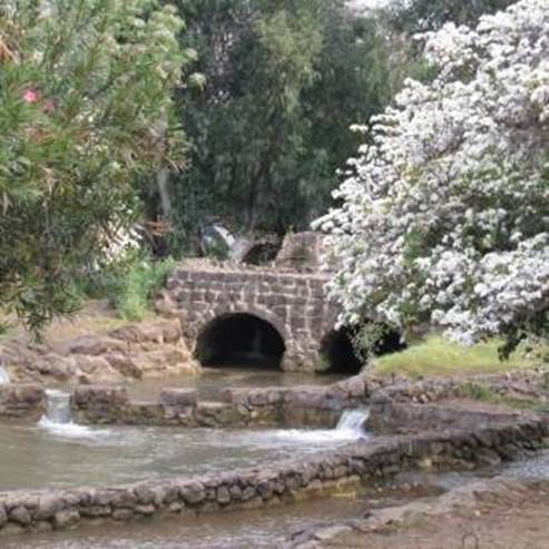
The Meshushim Pool
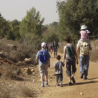
A variety of routes for families and for those who enjoy hiking
Nahal Meshushim respresents the best the Golan has to offer - deep canyons, flowing rivers and springs, ravines and waterfalls and an ancient site. The Israel Nature and Parks Authority has set up an accessible trail, enabling those with impaired mobility to enjoying the Reserve and its scenery.
Main points of interest:
A fun water area
The basalt landscape of the Golan
Yehudiya Forest plantlife
Dolmens - pre-historic tombs
Viewpoints
The Lookout Path provides a spectacular view over the Nahal Yehudiya Reserve and the Golan.
Israel Nature and Parks Authority activities to improve visitor services and preserve the site
The Authority has installed a toilet complex, drinking taps and picnic tables. It has also laid out trails for hiking through the Reserve, added signposts and explanatory signs.
How to get here:
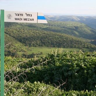
Around 3 km north of Had Ness (Route 888, between kilometre signs 5-6), turn east onto a gravel road. After around 2.5 km you will reach the Nahal Meshushim car park.
Background
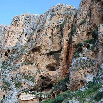
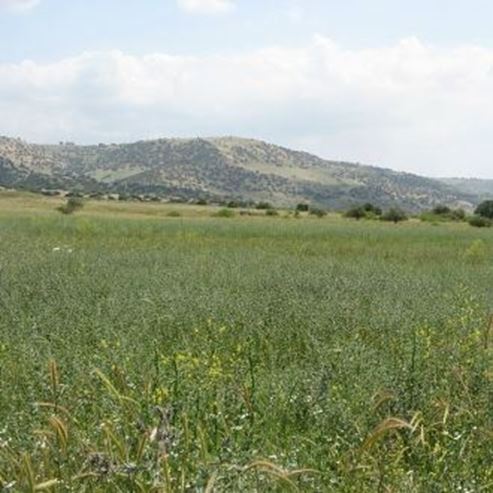
Nahal Meshushim is part of the Yehudiya Forest Nature Reserve. The Reserve, which is the largest in the Golan, spreads over 66 km2. Most of the area is a high region with deep channels running through it, and water flowing through these all year round. The ground slopes downward from a height of 600 m above sea level to around 200 m below sea level.
Five streams flow through the Yehudiya Forest Reserve. The northernmost stream is Nahal Meshushim. This is around 35 km long and is the longest perennial stream in the Golan.
Its upper streams flow to the foothills of Mount Avital the Bashanit ridge. At its start, the stream flows through shallow canal. This forms an impressive basalt canyon within the Yehudiya Forest Nature Reserve, including waterfalls and pools, among them the famous Hexagon Pool.
Nahal Meshushim flows into the Kinneret in the Beit Tsaida Valley (Betiha). Due to the moderate incline, the waters of Kinneret flow back into the mouth of the stream, and this is known as the Zaki Lagoon. The lagoon is a unique habitat, which contains views of meadows and swaps which are rare in Israel.
Nahal Meshushim has a wide drainage basin of 160 m2, and it is the only stream in the Golan whose waters are not gathered in reservoirs. As a result, when it rains a large amount of water flows through the stream, and because of this danger, descending through the channel when it is raining is forbidden.
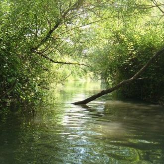
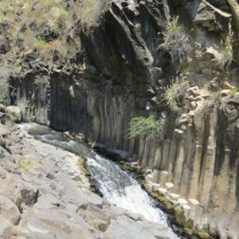
The Hexagon Pool
The Hexagon Pool is breathtaking in its beauty. The Hexagon Pool flows form a gentle waterfall into a large pool at the foot of a straight basalt cliff, composed of very many basalt pillars, each around 50 cm in diameter.
Most of the pillars are hexagonal (with six equal sides), and it is from this geometric shape that the pool and the stream get their names.
The basalt was formed from burning hot lava which burst forth from the depths of the earth. When exposed to air the lava cools, shrinks and cracks. A hexagon is one of the few shapes which can be used to form a flat surface without leaving gaps between sides (other shapes are the square and the triangle). The circumference of the hexagon in relation to its area is smaller than other shapes, and as such creating something hexagonal requires less energy than creating other shapes does, so it makes sense that when the lava cooled, hexagons were formed before other shapes.
Trip route
1. Viewpoint path
Length of route: 300 metres
Trip length 10-15 minutes
About the trail: Very easy circular route, accessible for people using wheelchairs.
From the square at the entrance plaza follow the signs pointing to the ‘Lookout Trail’. After a short walk you will reach a fabulous lookout balcony (the ‘southern balcony’) which looks out over the spectacular view of the Yehudiya Reserve, including Nahal Meshushim and Nahal Zavitan which flow to the bottom of the lookout balcony around 100 m below.
The Yehudiya Forest can be seen in all its glory from the lookout balcony, characterised by the large spaces between the trees with many weeds in these spaces, and you can see from afar the peak of the Hermon and the Golan’s volcanic mountains - Bental, Avital, Shifon, Yosifon and Peres - as well as the Bashanit Ridge (the ceasefire line with Syria which runs through here).
The trail continues along the bank of the stream to another lookout balcony (the ‘northern balcony’), and returns from there to plaza and the exit point.
2. The Dolmen Trail
Length of route: 700 metres
Trip length Around 20 minutes.
About the trail: Easy circular route, accessible for people using wheelchairs.
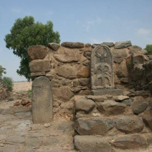
From the square at the entrance plaza take the path going south, following signs pointing to the ‘Dolmen Trail’. The dirt track crosses the car park shaded by eucalyptus trees and turns to the left (east) in an open field between mounds of stones. At the edge of the field, in a small eucalyptus grove, is a small structure made from a large, crude basalt stone. The stone is laid on top of smaller stones, like a huge table, and together they create a structure with an opening facing to the south.
This is the dolmen. A dolmen is a large tombstone. The name ‘dolmen’ comes from the ancient Breton language. ‘Dol’ means table and ‘men’ means stone. In Brittany (north-western France) pre-historic stone structures were discovered, which look similar to the dolmens in the Golan.
Hundreds of dolmens are spread throughout the northern and central Golan. When were the dolmens in the Golan put up? This is the question that occupies the minds of the researchers, and they do not have an accurate answer. Some believe that the dolmens were built during the Early Bronze Age (3rd millennium BC) and some believe they were built during the Middle Bronze Age (start of the 2nd millennium BCE), but both of these groups are in complete agreement on one thing: The dolmens were used for burial. Various types of dolmens have been discovered in the Golan, some relatively small and made out of just three stones, and others which are huge and have burial chambers of 1.5 to 2.5 m.
After the dolmen the trail continues east towards the banks of Nahal Meshushim, and from there to the north and the fabulous scenery of the Yehudiya Reserve. The Dolmen Trail meets the Lookout Trail at the southern balcony, and from there both return to the plaza.
Other hiking paths at Nahal Meshushim:
The hiking paths begin from the plaza next to the car park and return back here.
Map: You must carry an ordnance survey map and a list of the path signs for the Golan and the Hermon (Issue no. 1).
3. Pool route
The classic path through the reserve. This is about 2 km long and ends up at the Hexagon Pool (20 minutes down the slope and around 30 minutes back up the same way). Suitable for families who like hiking.
4. The stream oath
The path is 3 km long. This path also goes to the Hexagon Pool. You can return to the car park via the pool path. Suitable for experienced hikers.
- Type
- Hiking
- Region
- North
- Near to
- Tzfat
- Length
- The observation trail: 300 m, the Dolmen Trail: 700 m.
- Duration
- About Half hour
- Recommended season
- Spring, Summer, Autumn, Winter
- Starting point
- Nature Reserve Meshushim River (map)
- Ending point
- At the starting point (map)
- Special equipment
- Shoes for walking in the water, a hat, a bathing suit, a change of clothes
- Precautions
- Do not jump into the Meshushim pool. In the summer, you must have plenty of drinking water
- Parking
- Parking
- Accessibility
- Accessible
- Circular
- Circular
- Drinkable water
- Drinkable water
- Bathing water
- Bathing water
- Suitable for children
- Suitable for children
- Picnic suitable
- Picnic suitable
- Phone
- +972-4-682-0238
Similar trails


Nearby attractions

Nearby restaurants


Meatshos - Katzrin