To Rehavam’s Arches
A one way road
The Israel Nature and Parks Authority is a partner in the planning of the Golan Trail. This section of the
trail leads visitors to Nachal Samach and the fascinating synagogue at Rehavam’s Arches (Umm el
Kanatir). New signs have been put up at the entrance to the trail, and a campsite has been set up at the
Daliyot parking lot. A drinking water tap has been installed next to Mazraat Quneitra.
Main points of interest:
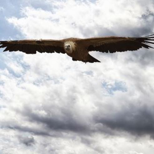
Flowing stream
Golan flora
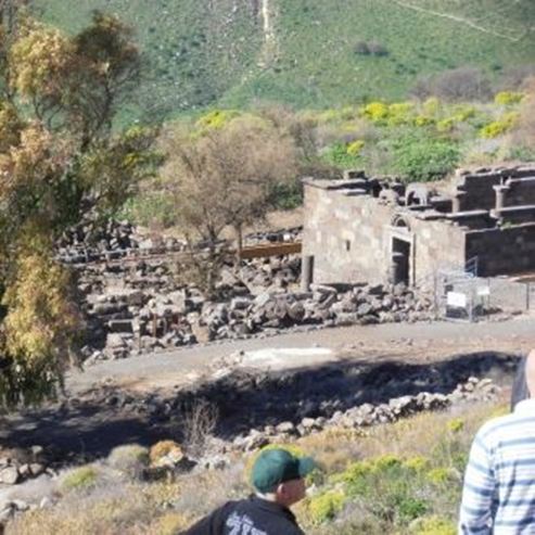
Rehavam’s Arches synagogue
Viewpoints
A spectacular lookout over the southern Golan from the Rehavam’s Arches synagogue.
Israel Nature and Parks Authority activities to improve visitor services
The Israel Nature and Parks Authority is a partner in laying out the Golan Trail (signposted white-blue-
green).
How to get to the Daliyot parking lot:
Turn into the Daliyot parking lot from Route 869 (between km signs 15-16), around 700 m west of the
Daliyot junction.
How to get to Rehavam’s Arches:
Go along the access road to Natur, and turn left after 3.3 km (around half a kilometre before the
kibbutz). Go along the paved road for around 3 km, until you reach the parking area for the Rehavam’s
Arches site (Umm el Kanatir).
Background:
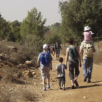
The Golan Trail is a marked hiking trail, around 120 km in length. The trail crosses the whole of the
Golan, from the Hermon to the southern edge of the Golan. The route planners have divided it into 15
sections. Each section is suitable for ordinary travellers and even family trips. Experienced hikers can do
two sections a day and finish the trail within a week. Signposts have recently been added at points
where the trail crosses the Golan’s roads. This path constitutes section no. 10 of the trail.
Trip route:
1. Mazraat Quneitra
The Daliyot parking lot is the Golan’s main campsite, largely thanks to its strategic position. You can go
north by foot to the Daliyot stream and get to the Gamla Reserve, but this trip will go south, following the
Golan Trail route.
Cross Route 869 carefully, and after a few hundred metres you will pass the ruins of Mazraat Quneitra.
A town was set up in this location in around 100 AD, filling the gap left by Gamla after it fell to the
Romans.
Around 100 m south of the ruins you will reach a dirt track. The Golan Trail continues straight in front of
you, but those who want to fill up their water bottles can walk 300 m to the east, to a Mekorot facility
next to Route 808, where there is a water tap for hikers.
2. Roman Road
After around 1.5 km you will reach a dirt track following the path of a former Roman road. When this was
built it was covered with stone, and its sides were paved with large and prominent stones. The road
went up from the fields of Ramot to the ruins of Rasem Balut, around half a kilometre west of here. Part
of this road has been a traffic route since the Iron Age, which led to Hanvat Orha (Jokhdar), and from
there to Damascus. It seems that in Roman times, this was a major route which connected the Land of Israel with Syria.
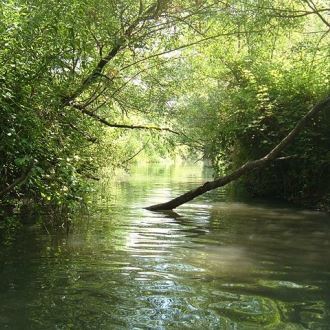
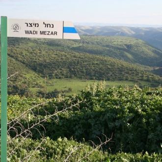
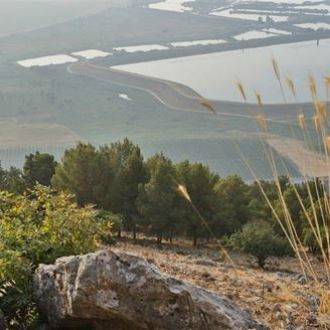
3. Nachal Samach
The Roman road and the Golan Trail cross the ruins of Rasem Balut. Next to the ruins we will discover
the northern edge of the Revaya Reservoir (Samach). The Golan Trail continues for 700 m across the
reservoir’s dam, and goes down to the Nachal Samach channel. The stream is very shallow at this point.
In February and at the start of March, the areas to the west of the reservoir are covered with a
magnificent carpet of red and purple anemones.
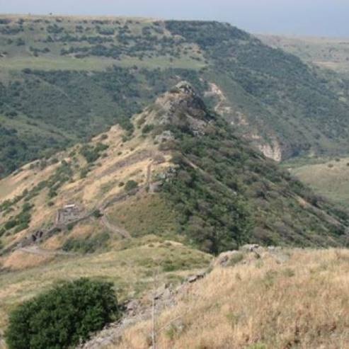
As you continue, the stream becomes deeper, and a bend towards the left will appear suddenly. At the
bend on the stream, a large and beautiful volcanic plug stands out at a height of around 20 m. Its face
creates a grooved cliff with polygonal columns.
The path goes down to the channel of the flowing stream, crosses a tunnel of reeds and comes to a
large bridge built from basalt. This is the ‘Syrian Bridge’. The Syrians built it when they created a dam in
the canal to divert water from the Banias and the Hasbani to the Golan, and from there to the Yarmuch.
The digging of this canal was one of the reasons for the outbreak of the Six Day War. Today, the
shadow of the bridge with the water flowing under it is a great place to stop for a rest.
Continue walking. The Golan Trail climbs upwards towards the south. After around 2 km you will reach
the end of this section of the Golan Trail, and the sign here will tell you so. Now go up to the left on the
path marked in black. Around 200 m later this will join a path marked in white. Opposite this point, the
Hakshatot spring flows from the cliff.
4. Hakshatot Spring (Umm el Kanatir)
The name of the spring is a translation of its Arabic name (Umm el Kanatir / Spring of the Arches), and it
is exactly as its name says. The water flows towards pools in the shadow of three beautiful stone
arches. The building style suggests these were built in the Roman period. Today one arch remains
intact, as well as part of an additional arch. One hypothesis is that this place was used as a factory for
whitening linen clothes, which seems to have been the main occupation of the residents of the village. In
ancient times, linen clothes were considered high-quality, and were very expensive, but the
disadvantage was their yellowish colour. It is possible that the residents of the village knew how to
whiten linen, and this knowledge made them very rich. However, it is also possible that this place was
something else entirely. The flowing spring facing the view of Nachal Samach and the Kinneret is also
an ideal place for pagan ritual and worship of the forces of nature.
Today the place is called Rehavam’s Arches, named for Rehavam Ze’evi ('Gandi’). When he was
Minister for Tourism, Ze’evi visited this place in 2001, a few days before he was killed by terrorists. A
paved path lined with trees and benches leads to the Jewish town’s ancient synagogue, which existed
here in the Mishnaic and Talmudic periods.
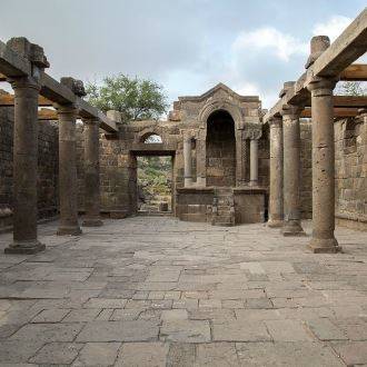
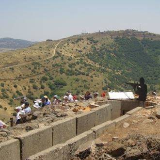
5. Rehavam’s Arches synagogue
By the end of the 19 th century, the large pile of stones here had been identified as a remnant of an
ancient synagogue. Excavations began in 2003, and later the synagogue was restored under the
guidance of Yehoshua Dray (‘Yeshu’), and archaeologists Ilana Gonen and Haim Ben David.
The findings are spectacular. Today the facade of the synagogue and its entrance are almost complete,
as well as substantial parts of its other walls. Two rows of columns from the main hall remain standing.
The highlight of these discoveries is the shrine - a magnificent ark on the southern wall of the
synagogue, facing Jerusalem. It is around 5 m tall, and has been almost perfectly preserved. The
entrance to the bimah is in the form of an arch, raised on two ornate pillars. Next to each pillar is a
column bearing an ornate crown with geometric patterns and eagles. A stone staircase leads up to the
bimah. The doorposts are beautifully engraved with vines growing out of an amphora, and arches,
geometric shapes and cornices. The head of each column has a relief depicting a menorah. Decorations
depicting other Jewish symbols were also found, such as a coalpan, a shofar and the four species.
Steps lead from the synagogue to the site's car park. The area can also be reached via a paved road.
- Type
- Hiking
- Region
- North
- Near to
- Tiberias
- Length
- 11 Km
- Duration
- 5 Hours
- Recommended season
- Spring, Summer, Autumn, Winter
- Starting point
- Dalyot Parking Lot (map)
- Ending point
- Um Al-Qanatir (map)
- Special equipment
- Walking shoes, hat, water
- Precautions
- In the summer should bring plenty of water
- Parking
- Parking
- Drinkable water
- Drinkable water
- Picnic suitable
- Picnic suitable
Similar trails


Nearby attractions


Nearby restaurants
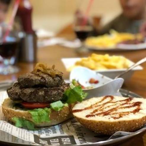


Meatshos - Katzrin