Ramon Colours Route
Travel and observation point
The Quarry Rehabilitation Fund and the Israel Nature and Parks Authority has restored the abandoned mining and quarrying region at the heart of the Ramon Crater. This is the Ramon Colours Route - an open-air geological museum which displays a wealth of colourful rocks and fascinating natural geological phenomena.
Main points of interest:
Restored abandoned quarrying landscape
Factory for producing fire-resistant bricks
Viewpoints
Several lookout points along the route
Israel Nature and Parks Authority activities to improve visitor services and preserve the site
The Authority has restored a landscape of open quarries, paved a road suitable for all vehicles and set up explanatory and illustrative signs - all in preparation for the site to be declared a National Park.
How to get here:
From the Ramon Crater Road (Route 40, between kilometre signs 86-7), around 3.5 km south of the entrance to sawmill, turn east onto the new dirt track. The white separation line does not allow you to turn left when coming from Mizpe Ramon. If you are coming from this direction, continue for another kilometre, turn right down the dirt track and turn back carefully.
Background
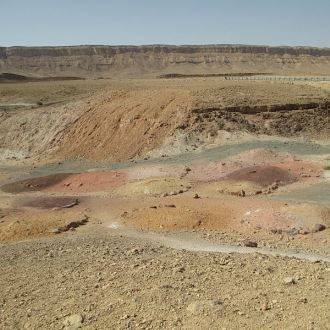
In the years after it was established, the State of Israel identified the Ramon Crater as a good location to set up quarries. Flint-like clay - the raw material for producing bricks and fire-resistant products - was mined for many years in the space between the Reved Hills and Be’erot. The quarries left huge holes, 20 m deep and more, reaching ground water level in some places. Tall piles of dirt were heaped up next to them, since in order to reach the mineral layer, higher up layers of rock had to be removed.
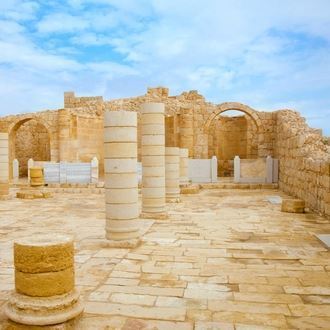
When the Nature Conservation Authority (today the Israel Nature and Parks Authority) was set up in the mid-60s, the eastern part of the crater was declared a Nature Reserve. The Authority worked for many years to increase the area of the Reserve in the crater, and in the end succeeded. In the 90s, the Government of Israel decided to reduce mining in the crater, and at the start of the 2000s mining was banned entirely. Part of the restoration of the Ramon Crater was the establishment of a national geological park at the heart of the crater, since the exposure created by the quarries allows geological phenomena to be seen. The master plan for the park was drawn up by Braudo-Maoz Landscape Architects. The park has not yet been completed, but you can already travel along its main path and enjoy the fabulous views.
Restoring the quarries
The Quarry Rehabilitation Fund works to restore abandoned quarries, and has set aside a generous budget to restore the flint-like clay mines and turn the area - around 3,000 dunams - into an open-air geological museum. So what is this restoration? The conservative approach says that the original state must be restored, but this is not a feasible demand. There is no way to replicate the former topography exactly, and of course it is not possible to return the Earth's crust, which has been naturally formed over the course of thousands of years, along with its single-cell organisms, to its former state. That said, the practical approach proposes a three-stage restoration: Ecological Restoration - a process which helps the damaged, lapsed or destroyed ecosystem to recover (those responsible for the restoration are researching similar areas which have not been damaged, and are building a new system); Ecological Rehabilitation - creating a reasonable ecological situation, with positive and pleasant conditions; and Ecological Reclamation - stabilising the land and drainage system, preserving public safety, aesthetic improvements and returning the area to the public to use again.
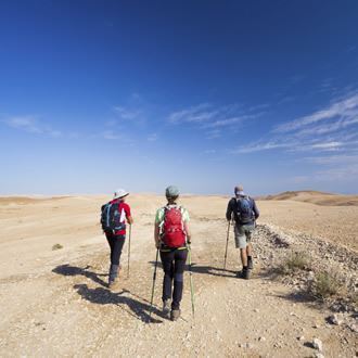
Trip route
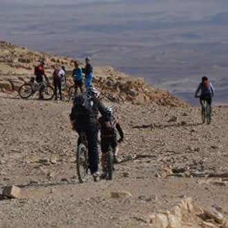
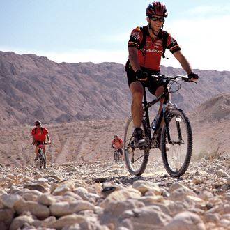
The Ramon Colours Route connects Route 40 to the Be’erot car park. It is around 7 km long and is signposted with blue trail signs. Lookout points over the area have been set up along the route, complete with parking areas. Mountain biking paths come off the main Route.
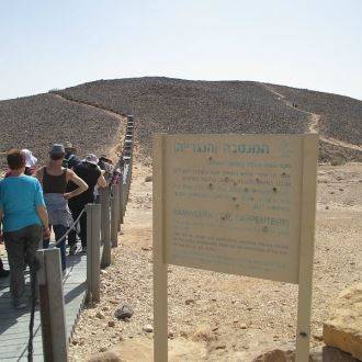
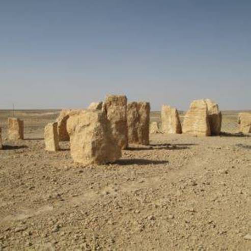
1. Entrance to the path
At the entrance to the path are two grey Mohila formation chalk stones, which create a kind of pyramid, and next to them is a piece of metal from the brick factory. A visitor lobby is being planned at this location.
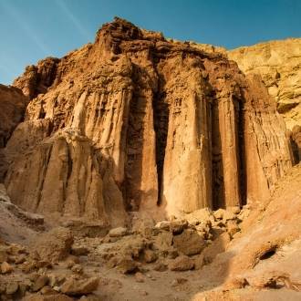
2. A quarry at eye level
From this area, around 2.5 km from the entrance, you can see a high quarry wall. Here you will be impressed by the dark purple Mashkhor formation rocks, known as flint-like clay. These rocks are the oldest in the crater, from the Jurassic period. They are mainly made up of iron and aluminium oxide, and today land of this kind is mainly created in the rainy equatorial region. Flint-like clay has no connection to flint; the rock received this nickname since large parts of it have a tendency to break on smooth surfaces, and their shape is reminiscent of flint shards.
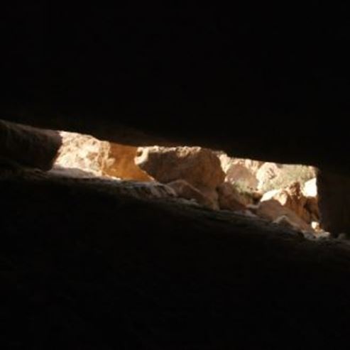
3. The hideaways
Around 300 m further on, you will see the openings of two small caves on the left, which are covered with built stone walls. These are the hideaways (‘matamir’ in Arabic) - places where the Bedouins would store extra equipment when traveling through the desert.
4. The factory
A large rock at the centre of the path, around 400 m from the hideaways, marks a crossroads. To the right of the crossroads you can see a sort of huge cannon. You can easily park nearby. Mishkhor rock formations were used in the past as raw material for fire-resistant bricks, and the cannon-shaped pipe is a kiln left over from the factory. According to the plans, a visitor centre and fossil museum will be built here, but even now the place is very impressive. Next to the factory you can see the ‘moon’ dunes made of the colourful and beautiful sands of the 'Hatira’ formation.
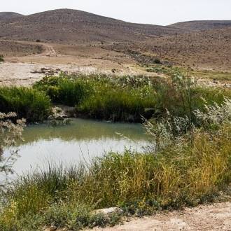
5. The quarry
A levelled dirt path leads down from the junction opposite the factory to the flint-like clay quarry. The quarry reaches ground-water level, and in rainy winters a lake forms inside. Inside the quarry you can see that Mishkhor formation rocks do not create a continuous layer, but rather appear in spots which fill karst spaces and holes in the chalk rocks they were left in. This is another testimony to the formation of these rocks in the heavy rain geological period, during which karst holes and caves were formed.
You can see the quarry or the lake (in rainy winters) from the parking area around 400 m after the crossroads. According to the plans, in the future you will be able to ‘float’ over the quarry on a bridge suspended between the parking area and the cliff wall on the other side of the quarry.
Han Be’erot
Han Be’erot offers camping areas with gazebos for sleeping under stars, two large, heated Bedouin tents with mattresses, and fitted guest pavilions for 6 people. The campsite has toilets and hot showers, eating areas, gazebos, bonfire areas (you can buy flammable materials at the campsite), electricity points and lighting. At weekends (Thursday-Saturday), individual travellers can come and sleep outdoors or in the Bedouin tents with no need to book in advance. For weekdays, please book in advance. Groups must book a visit on any day.
Telephone number for bookings: 08-6280404 ext. 1
Photo - Pikiwiki Web
- Type
- Hiking
- Region
- South
- Near to
- Mizpe Ramon
- Length
- 7 Km
- Duration
- 2 Hours
- Recommended season
- Spring, Summer, Autumn, Winter
- Starting point
- The Ramon Crater (Makhtesh Ramon) (map)
- Ending point
- Han Be'erot (map)
- Special equipment
- Shoes, hat, water
- Precautions
- The turn from road 40 to the dirt road that leads to the top of the route is permitted only from the south
- Parking
- Parking
- Accessibility
- Accessible
- Drinkable water
- Drinkable water
- Suitable for children
- Suitable for children
- Picnic suitable
- Picnic suitable
- Phone
- +972-8-6280404
Similar trails
Nearby attractions
Deep Desert Israel
Nearby restaurants


Rebar Be'er Sheva, Negev Mall