Ardon Mountain Circle Track
Climbing a mountain and getting off it
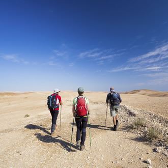
The Israel Nature and Parks Authority has marked out a new path in the Ramon Crater, which allows you to walk around Har Ardon on a circular trail. This is another window onto the gorgeous views of the Ramon Crater.
Main points of interest:
The geological structure of the Ramon Crater
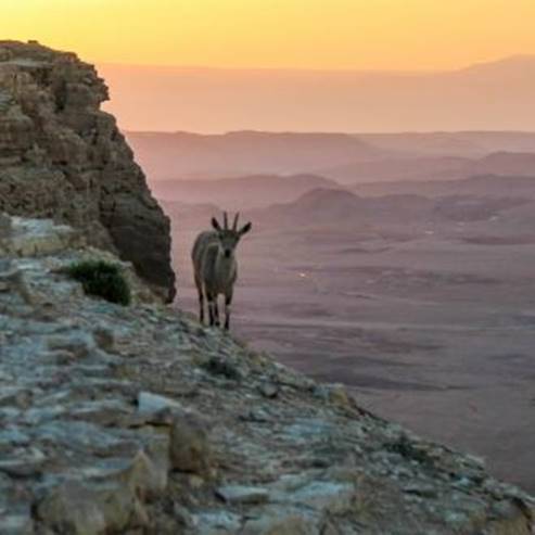
Desert plantlife
Viewpoint
A spectacular viewpoint from the top of Har Ardon, over the Mahmal Valley, the Ardon Valley and the landscape of the Crater.
Israel Nature and Parks Authority activities to improve visitor services and preserve the site
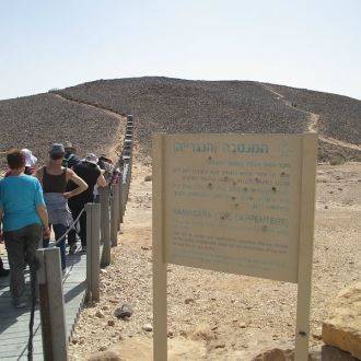
The Authority has set up an access path to the start of the trail which can be used by all types of vehicle, as well as a campsite at the foot of Har Ardon. The Authority is also responsible for marking out the path on Har Ardon.
How to get here:
Travel south from Mizpe Ramon on Route 40, and go down to the Ramon Crater. A sign inside the crater (between kilometres 86-7) points to the left to Hen Be'erot, on a dirt track marked in red. At the meeting between the Petroleum Road (marked in black), turn left to get to Hen Be'erot. From the campsite continue north for 2.5 km on the road marked in black, and turn right after the paths marked in blue. The road ends at the Har Ardon car park, and this is where the walking path begins.
Background
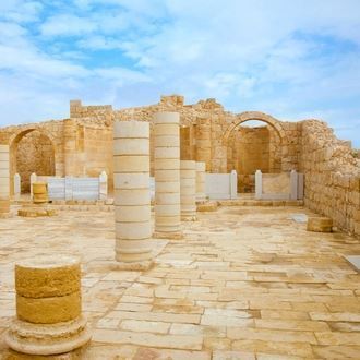
The name of the Ramon Crater was probably taken indirectly from the Spice Route. Local Bedouin residents have identified the Spice Route with the road the Romans used, and as such named the area and the stream which drains the crater ‘Wadi e-Rumman’. At the heart of the crater you will cross the Spice Route - one of the most important trade routes in the ancient world. The route came up from the Arabian Peninsula to the south and crossed the Negev on its way to the ports of the Mediterranean Sea. Caravans of camels carried valuable commodities such as spices, perfumes and fabrics from India, East Africa and ‘Arav Hamevurakha’ (in modern day Oman) where they grew Boswellia plants. At the time the Nabateans ruled over the Negev, and they gained great economic benefit from their strategic position, as we can see from the opulence of their cities at Petra and Avdat.
In 2000, UNESCO gave World Heritage status to four sites in Oman. Five years later they added four Nabatean cities in the Negev to the list of World Heritage Sites.
Trip route
1. By car: from Hen Be'erot to the Har Ardon car park.
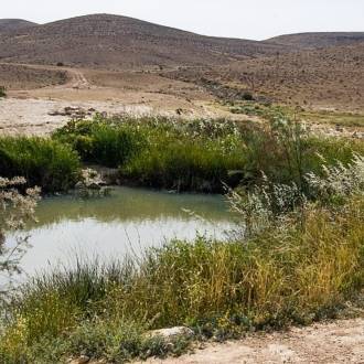
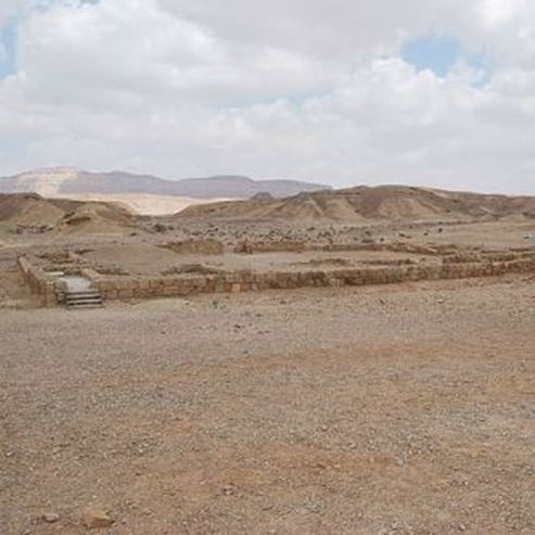
The Hen Be'erot campsite is currently the main campsite in the Ramon Crater. To the south of this, remains of a building from the Byzantine period have been uncovered. Its residents took advantage of the high ground water at this location.
From Hen Be'erot travel north on the road marked in black along the Eilat-Ashkelon oil line (EAPC), hidden in the ground here. To your right you will be able to see the steep cliff of Har Ardon throughout the journey. After around 2.5 km (after you pass the road to Ramat Saharonim), turn right on the road marked in blue to the Har Ardon car park.
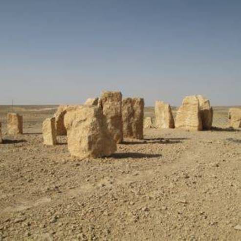
2. Ancient milestone
Before you reach the car park it is worth getting out of the car at the point where the path marked in black crosses our road. Around 100 m south of here (on the black path) is a milestone from the Roman period - first-hand evidence that this is indeed the original ancient Spice Route.
3. To the top of Har Ardon
Har Adon (Ras a-Radiha) is named after the biblical character Ardon. All we know about him is that he was the son of Caleb son of Hezron of the Tribe of Judah (I Chronicles 2.18).
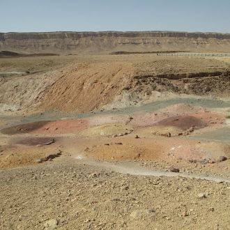
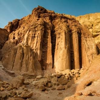
A path marked in blue ascends from the car park to a narrow and reasonably steep extension. After 400 m the extension goes down a little, and at the bottom of the ridge colourful sands will appear. The little rain that falls in the crater flows quickly down these slopes, and as such they are totally arid.
After climbing another 400 m, we will see a path marked in black coming from the Har Ardon campsite. After this the path remains at the same height, passes through a narrow passageway over the rock face, and prepares hikers for the final climb on the way to the top of the mountain. Here we will take a relaxed walk up the moderate slope and walk past a deep crack in the hard limestone which covers the mountain. This crack, like many of those in the cliffs surrounding the Ramon Crater, is the result of pressure exerted on the Ramon anticline. The most common plant here is the bushy bean-caper, a desert shrub which grows on graduated walls.
At the end of the climb you can stop, take a deep breath and absorb the view. Har Ardon is part of the eastern side of the Ramon Crater, and it splits the eastern part into two valleys - the Mahmal Valley to the north and the Ardon Valley to the south. Against the backdrop of the Mahmal Valley you will get a good view of the crater’s northern cliff. Next to the crater, behind the Petroleum Road, a volcanic basalt hill stands out, and above the winding Route 40 you can easily catch a glimpse of Mizpe Ramon.
To look over the Mahmal Valley, continue walking on the path for another few hundred metres and you will reach the highest point of the trip: 700 m above sea level and 200 meters above the starting point of the hike. The scenery is spectacular. From here you can see almost the entire length of the Ramon Crater - 40 km. It is around 9 km at its widest point. At the foot of the mountain you can see the colourful Adom Valley and Harut Hill, and not far away is Hen Be'erot. On a clear day you can see as far as Har Sagi and Har Arif to the west, and the Edom Mountains to the east.
4. From the peak to the exit
Walking through the gentle slopes of Har Ardon is easy. Har Ardon’s peak is one of the most isolated of the Negev mountain, surrounded by cliffs and steep slopes. In the past the peaks were joined together, but they were separated by erosion, the formation of the craters and the downcutting of Nahal Cin and other deep streams.
Har Ardon was a syncline between anticlines. Part of the process of the formation of the Ramon Crater was the rapid downcutting of the anticlines next to it, and as such the ridges became valleys and the syncline became a mountain.
The path which descends from Har Ardon to the valley is steep and must be approached carefully. In the valley we will discover a new world of white sandstone. The plantlife changes immediately, and the main representation of this is the white broom, known for its wand-like leaves.
After walking for around a kilometre among the enchanting white sands (on the path marked in blue), you will reach the Shvilim junction. The blue path continues to Harut Hill and Nahal Ardon, and in order to get back to the exit, turn right here to the new path, marked in green. This is a walk of around 3 km between red sandstone, iron-rich rocks and a colourful landscape. The trail is a short distance from Har Ardon and follows the paths of shallow streams which are easy to cross.
Preserving the view
The new path is intended to allow people to visit Har Ardon in their own private vehicles, and reduces the need to change cars. The path goes through an ancient area. Please do leave the path, do not make any carvings in the rocks, and help us to preserve the beauty of the crater.
Photo - By Amitaytay Wikimedia commons
- Type
- Hiking
- Region
- South
- Near to
- Mizpe Ramon
- Length
- 7 Km
- Duration
- 5-4 Hours
- Recommended season
- Spring, Autumn, Winter
- Difficulty level
- Medium
- Starting point
- Mount Ardon parking (map)
- Ending point
- Mount Ardon parking (map)
- Special equipment
- Hat, Shoes, Water
- Precautions
- Be very careful down the steep slope of Mount Ardon
- Parking
- Parking
- Picnic suitable
- Picnic suitable
- Phone
- +972-8-6588691
Similar trails

Nearby attractions
Nearby restaurants

Rebar Be'er Sheva, Negev Mall