Cycling Route From Be'erot Camping Site to Moa
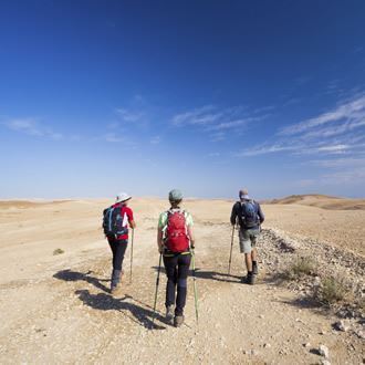
Cycling
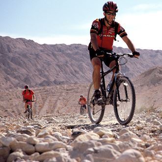
The Israel Nature and Parks Authority planned and marked this segment of the Israel National Trail for bicycle riders, for a ride reminiscent of the camel caravans that used to traverse the area along the Incense Road. In 2005 UNESCO inscribed the Incense Road as a World Heritage Site.
Main Points of Interest
The Incense Road
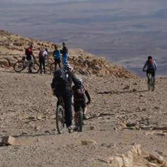
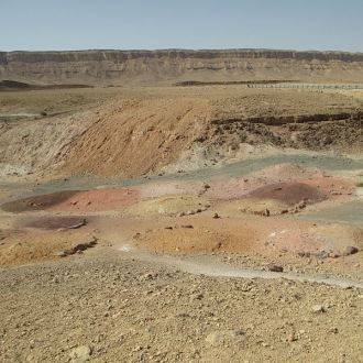
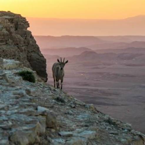
Desert scenery
The Nabataean sites Bor Nekarot, Kasra ruins and Moa ruins
Scenic Lookouts:
The Kasra ruin
The Moa hill
The Israel Nature and Parks Authority’s Actions to Improve Service to the visitors:
In addition to laying and marking the bicycle trail, the Authority prepared a lodging site at Be’erot Khan, with tents, restrooms, hot showers, and a kitchen where visitors can cook (for a fee).
Getting to Be’erot Khan
From Mitzpe Ramon drive south on highway 40, down to Makhtesh Ramon. Between the 86 and 87 km marks, a sign in the makhtesh directs visitors to turn left towards Be’erot Khan via a dirt road marked in red. The khan is approximately 4 km away, and can be reached by car.
Getting to Moa
On highway 90 (Arabah road), about 1.5 km south of the entrance to Tzofar and between the 129-130 km marks, turn west, and follow the black markings for 2 km until reaching the Moa foothill. Cyclists can keep riding towards moshav Tzofar, where public transport is available.
Background
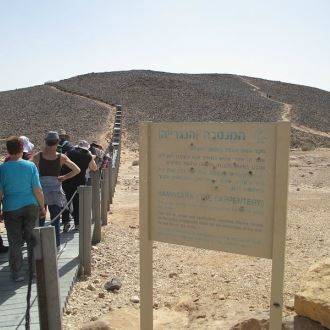
Recently the southern part of the Israel National Bike Trail was completed and marked, extending to 300 km from Mitzpe Ramon to Eilat, and divided into eight day-long rides. The beginning of each daily segment has an information point, with a map and explanations about the segment. The trail is marked with a blue circle designed as an arrow, indicating the trail’s direction.
The last segment has been designed with the help of volunteers as a memorial to Amit Yeori, who was killed in operation Protective Edge. The project was carried out by cyclists, employees of the Israel Nature and Parks Authority, the Central Arava Regional Council, fellow soldiers of Amit’s in the Combat Engineering Corps, and his family.
The Trail Route
1. Towards Nahal Ardon
The trail leaves Be’erot Khan heading east, crossing the colorful Ramat Saharonim. Observant riders may notice cairns of stones, lined up in two rows along both sides of the trail. These are burial cairns from the Intermediate Bronze Age (2200-2000 BC), left by desert nomads.
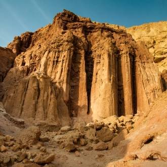
The trail descends towards the reddish-looking Nahal Ardon. The beautiful acacia tree growing in the channel is a good spot for a short break – even though until now riding down a slope has not been too strenuous. Further along the streambed are six upright dikes, piercing the cliff that is the northern bank of the canyon. These dikes are the result of magma bursting from the core of the Earth through the rocks at its surface. The dikes here are from the Jurassic Period (141-195 millions of years ago), the most ancient rocks seen in Israel.
2. Nahal Nekarot
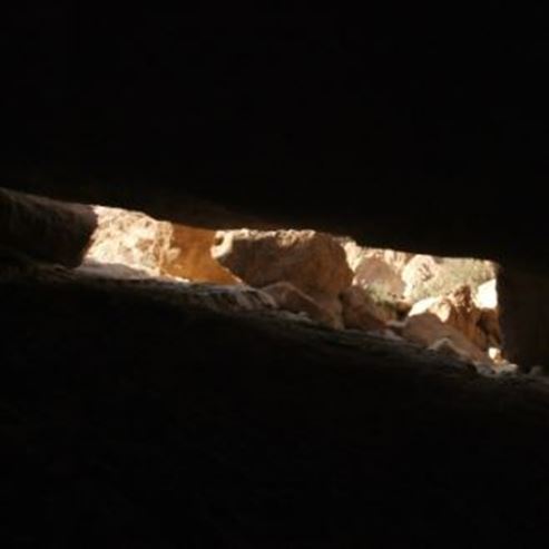
A short ride brings cyclists to Nahal Nekarot, where the trail turns east down to the bottom of the canyon. This part of the trail is about 9-km long, and includes a visit to the Nekarot fortress – a square watch tower that overlooked the Incense Road. During the Roman period this was a two-story structure. A small ravine some 200 meters away contains a well-preserved well that used to serve the occupants of the fortress. The top of the well is made of stone plates, resting on stone arches in characteristic Nabataean design. The riding terrain here is at either of the shoulders of the streambed – avoiding the gravel covering it, except when crossing the channel. Cross carefully, looking for the trail markings on the other side.
3. The Kasra Ruin
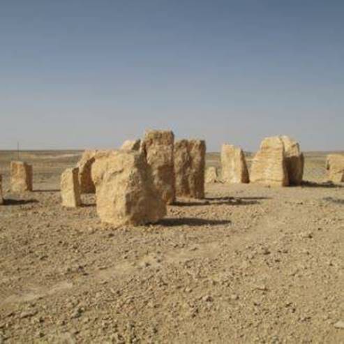
After another 4 km or so the trail leaves Nahal Nekarot, turning east towards Evus and Tsrorot. 3 km later the trail diverges from the 4x4 route, bypasses Har Masa from the south, ascending to the campground east of it. Next stop is the Kasra ruin – the remains of a watchtower and a small way station. This watchtower was square-shaped and made of hewn stones, but the surviving parts of its walls are only 3-meters high. After the construction of the tower, three rooms were also built just south of it, with the middle one serving as a yard open towards the tower and to the other two rooms to its east and west.
The descent from the Kasra ruin is very steep, so either ride very carefully, or even better, walk. The trail continues down to Nahal Kasra. Just a short way before reaching the Arabah, where Nahal Kasra connects to Nahal Omer (look for the sign so as not to miss the exit from the canyon), the trail diverges from the main channel, and proceeds north via a small streambed. It then climbs up towards the hills of Moa, and from there descends again to the Moa ruin, which is the remains of a large way station.
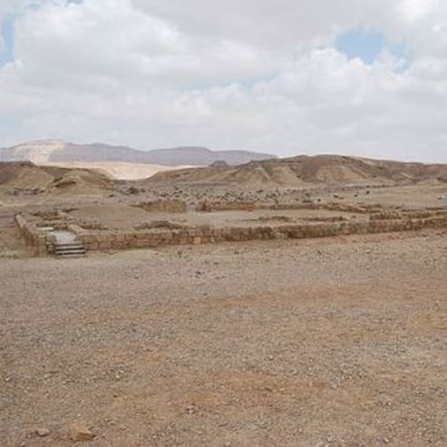
4. Moa
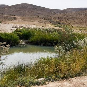
Most scholars are skeptical about the identification of this site as the Nabataean Moa mentioned in ancient literature, but the name became common among travelers. Moa or not, in the past the site was home to a perennial spring, which was the reason for the important way station established next to it. The significance of the location is that this is where the Incense Road meets the road that crossed the Arabah from north to south, reaching Eilat.
The main building is the inn – a 40x40-meters square structure built of hewn stones. One of the inn’s sections served as a bath. On a low hill west to the khan stands a fortress, consisting of 11 rooms surrounding a yard, one of which housed an olive press, as can be deduced from some of its remaining apparatuses. The site also contains a pool of water, as well as segments of an aqueduct driving water from the spring to the bath.
Here, at the foothill of Moa and along the road known as the “route of springs”, ends this segment of the Israel Bike Trail, and begins the next one: from Moa to moshav Paran.
Written by Hilel Zusman, manager of the Israel National Bike Trail project.
photo - By Ladyredsea, Wikimedia Commons
- Type
- Cycling
- Region
- South
- Near to
- Mizpe Ramon
- Length
- approximately 35 KM
- Duration
- 6-8 hours
- Recommended season
- Spring, Autumn, Winter
- Difficulty level
- Hard
- Starting point
- Khan Be'erot (map)
- Ending point
- Moa (map)
- Special equipment
- Helmet, gloves (additional protection is recommended), standard mountain bikes, repair tools, spare homes, pump, map or navigator.
- Map
- The Middle Arava and the Eastern Negev (Issue No. 17).
- Parking
- Parking
- Picnic suitable
- Picnic suitable
- Phone
- +972-8-6588691
Similar trails

Nearby attractions
Nearby restaurants

Rebar Be'er Sheva, Negev Mall