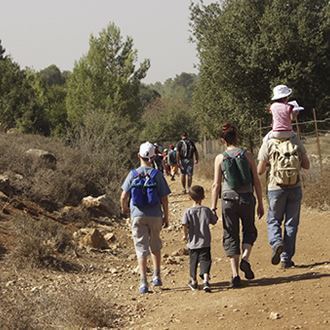
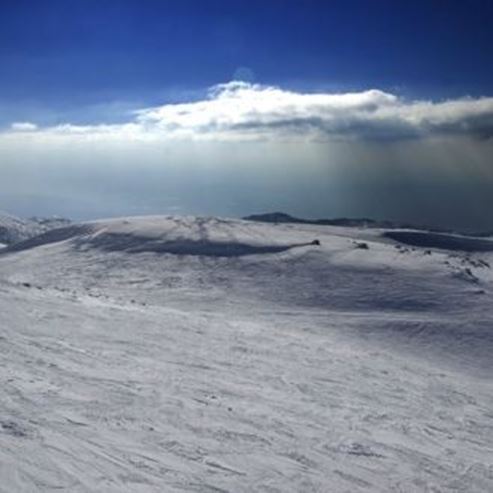
Cycle tour from Ram Lake to Banias River
Cycling
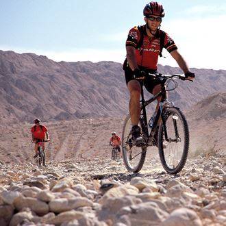
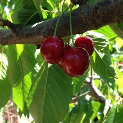
The cross-Israel trail separated from the Golan Heights at Lake Ram, crosses over amazing lookouts of the Hula Valley, continues the length of the steep decline of Nachal Sa'ar, and is full of adrenaline and excitement. The trail passes between huge basalt rocks, green spaces, cherry, plum and peach orchards, and ends on the banks of the raging Banias waterfall.
How to Get There:
Get on route 99, which ascends from Kiryat Shemona to the Golan Heights. The road ends at a Druze Village Mas'ade. Turn left with the signage to Lake Ram. After 800 meters turn right and follow the signs to the right, to Mas'ade above Lake Ram. Here is where you park.
The Family Trail
This trail is completely "family friendly", it is rated at medium difficulty. Please take into consideration that much of the decline is steep and there are also a few inclines as well.
Israel Trail
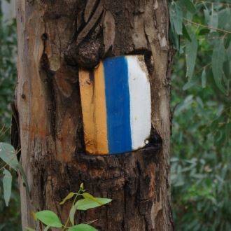
[0.00] [1] Left (southwest): From the parking lot in Mas'ade at Lake Ram to the road, after 30 meters turn left to the narrow road, without signs, but marked with the Golan Trail mark (White, Blue and Green). The trail goes over the
"blue-eye" of Lake Ram.
[0.40] 0.40 right (southwest): Continue onto dirt road from main road. Turn and ride with the Golan Trail markers.
[0.60] 1.60 left (west): Turn at T intersection and continue to ascend with the Golan Trail.
A- Nabi Elya
[0.80] 2.40 [2] right (northwest]:a-Nabi Elya tomb structure. Before continuing on the path it is recommend to veer to the left if the tomb and ascend the 100 meter incline to the top of the hill. From this point there is an amazing vantage point of the Hula Valley and the Ramat Naftali ridge that is in Israeli territory, and across – on the Ali Tihar ridge and Hatzbiah Valley in Lebanon. Take in the beautiful view and get back on the trail.
Ein Qiniyye
[0.10] 2.50 straight (north): A marked intersection, from this point continue on the trail marked in red. The road descends and winds sharply towards the Druze village of Ein Qiniyye. The trail turns into a narrow asphalt road, and the sharp winding road gets even harsher. Be sure to use you brakes! Stop and let them cool down. After a kilometer you will enter Ein Qiniyye and you will continue to descend with the road into the village center.
[1.70] 4.20 left (south): T intersection in the center of Ein Qiniyye. Descend with the road in the direction of the Nachal Sa'ar.
Hadidot Bridge
[0.90] 5.10 [3] right (west): continue on to dirt path from the road, prior to the bridge on Nachal Sa'ar. During the Six Day War the Syrian Army destroyed the bride in order to stall the Israeli troops. At the end of the war, Minister of Defense, Moshe Dayan ordered that the bridge be repaired in an attempt to build a relationship with between the State of Israel and the Druze in the Golan, which is where it gets its name – Hadidot Bridge (Friendship Bridge). Ride down the road, on the left Nachal Sa'ar will flow and on the right are primarily plantations. Upon each fork in the road, continue to the left, near the channel of the river (nachal).
[2.20] 7.30 left (west): join road 989, which leads from Sa'ar Waterfall to Neve Ativ. Ride down the road.
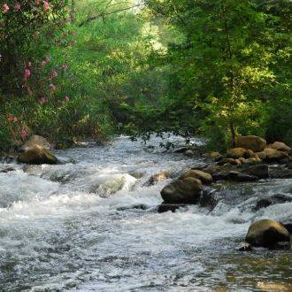
Sa'ar Waterfall
[1.00] 8.30 right (north): continue to dirt path from road, prior to the bridge on Nachal Sa'ar. From this point you can cross the bridge on the south bank and make your way to the Risisim (shrapnel) Waterfall lookout, one of the most impressive of the Golan Heights. In the winter, the waters fall with immense force and fires "shrapnel" everywhere. After the lookout, make your way back to the northern shore and descend the dirt path. After 300 meters, you will go through a gate into plantation land and you will ride down the main train between plantations. After 800 meters, you will arrive at a gate and leave the plantation area.
[1.50] 9.80 right (north): meet with road, across from the abandoned church at Panias. Follow the road down and after 300 meters you will see the entrance to the Banias Nature Reserve on the right. This is the perfect opportunity to take a dip in the cold water, with a cool Popsicle from the kiosk nearby. At the end of the visit, or if you have chosen to continue on and skip it, continue west on road 99.
The Banias Excavations and Tel Faher
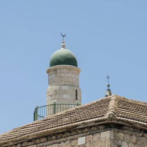
[0.40] 10.20 [4] left (south): road 99. Turn and ride on the road. On both sides you will see archeologic excavations of the Banias. "Caesarea Philippi", or known by its Hebrew name Banias, (from the name Panias) – is located on the shortest road connecting Damascus with Tyre and Sidon. It is among an area rich with vegetation and water, and it is well-known due to its fresh water springs and the cave in the mountain with its decorated walls and entrance. It seems that already in the 2nd century BCE the cave at the front of the cliff was dedicated to the Greek God Pan. Pan was half man and half goat, he was a scribe and a shepherd. He live in caves and is represented in art holding a flute made from cane. Before Pan Cave, at the foot of the cliff, the most important ritual area of the Banias is revealed: a westerly wall of the temple, identified with Herod's temple to Augustus. The wall, built of ashlars and marble slabs, was decorated with alternating oblong niches and arches.
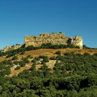
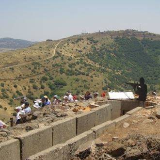
After 350 meters turn right (southwest) with signage of Tel Al Faher, and ride down the bumpy road. Tel Al Faher was a link in the chain of outposts established by the Syrian army over the Hula Valley settlements. On the fifth day of the Six Day War, the outpost was overtaken by the Golan Brigade. During this difficult battle, 34 Golani troops were killed. All of the commanding officers were either wounded or killed. The resourcefulness of the soldiers, their courage, their initiative and the dedication to the goal has made it one of the main memorial sites of the Golani Brigade.
Battle Legacy
[0.80] 11.00 straight (southwest): at the intersection. Continue straight on the dirt road marked with red. After 2km, you will see a small ascension surrounded by eucalyptus trees. This is Givat A'zaz (Tel Azziat) – a Syrian outpost that waged terror on residents of Jewish communities in the valley in the 1960's, and was conquered by the IDF in 1967. It is recommended to veer of the trail for a visit to the outpost and its viewpoint. Continue on the trail marked with red, which was a Syrian patrol route. The trail ascends and descends alternately.
[4.00] 15.00 [5] right (west): intersection. Continue on the trail marked with red and ride on the fast rolling basalt rocks.
[1.00] 16.00 right (northwest)
An intersection prior to Giv'at Ha'Em. Ride downhill on a wide, unmarked hill towards Nabi Huda.
Nabi Huda
[1.10] 17.10 [6] right (north): Intersection next to Nabi Huda. At this Druze Holy Site, you can stop and sit in the shade of the Eucalyptus Trees. From the intersection to Nabi Huda you will cross a gate that is closed to vehicles and through various plantations.
[1.20] 18.30 left (west): intersection at the banks of the Banias. Ride with the trail marked in black. On the left side there are plantations, on the right – the raging river channel, wherein on its banks are willow and sycamore trees that provide shade. You should stop your descent on the slope, go down one of the pathways leading to the ravine and look for wonderful cool spots on the edge of the river. Continue riding on the road marked with black to the left of the Banias.
[0.90] 19.20 [7] She'ar Yashuv Bridge on the Banias. Here the Israel Bike Trail ends. This point is represented as point 5 for the next trail
- Type
- Cycling
- Region
- North
- Length
- 19 Km
- Duration
- 2-4 Hours
- Areas of interest
- Water in Nature, Archeology / History, Nature and Landscape
- Recommended season
- Spring, Summer, Autumn, Winter
- Difficulty level
- Medium
- Starting point
- Ram Lake (map)
- Ending point
- Banias River (map)
- Map
- Number 1, the Hermon, the Golan and the Galilee
- Parking
- Parking
- Bathing water
- Bathing water
- Picnic suitable
- Picnic suitable
Similar trails

Accessible route between charming rivulets

Nearby attractions

Nearby restaurants