From Ayit Mountain To Kasuy Vally
Straight walking path (take care of the collection car at the end of the track)

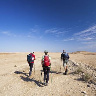
The Israel Nature and Parks Authority marked a new and challenging hiking trail in the Negev. The trail starts from Mount Ayit, passes through Shayarot Cliffs, and end with the wonderful sands of Nahal Kasuy.
Main points of interest
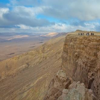
Lookouts to the vistas of the Arabah valley
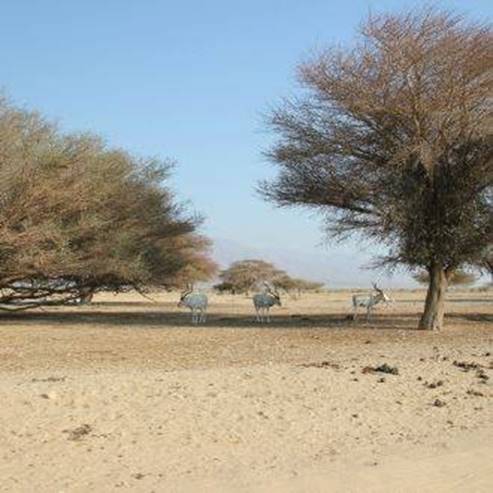
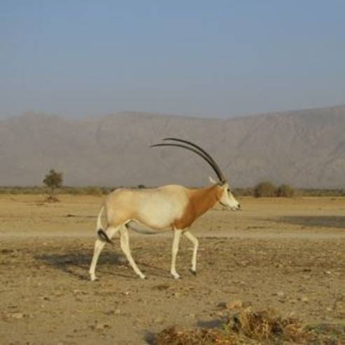
Desert plants
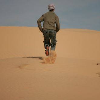
Sands of Nahal Kasuy
Scenic lookouts:
Lookouts from Mount Ayah and Mount Grofit to Arabah and the Mountains of Edom
What Israel Nature and Parks Authority does to better serve the visitors and to preserve the site
The Authority cleared the remains of an old army base at the trailhead, marked the trail, and arranged a campground near the Kasuy sand dune at the end of the trail.
Getting there:
From highway 90, at Ketura junction near kibbutz Lotan, take highway 40 going up west, towards Mitzpe Ramon. After 3.4 km you will pass the Mount Ayit lookout where the road bends. Go another 2 km past the entrance to an army base, and make a left towards a dirt road marked blue. The hiking trail begins 700 meters from there, at the meeting point of three different trails: blue, black and green. We are going to follow the trail marked green.
Background:
This area is part of the Shayarot Cliffs, and it extends to 140 km² between Haatakim cliff and the Uvda valley. The trail path reveals the Haatakim cliff that borders the length of the Arabah valley, and presents impressive lookouts from Mount Ayah and Mount Grofit. In the vicinity of Mount Grofit the trail turns to the west, up along Nahal Kasuy, and reaches a cluster of wonderful sand dunes. During rainy winters the dunes are covered with spectacular flower beds of blooming desert plants.
The trail route
1. Mount Ayah
Take the green trail to enter the shallow channel that deepens further along. After 300 meters pass under an overhead power line, and some half a kilometer later you will see the skeleton of a car that got here under unfortunate circumstances. From here you are alone in the classic desert setting, complete with the arid climate, and with almost no signs of civilization.
The area sees less than 50 mm of rain in a single year, which is the reason for all the vegetation being almost completely restricted to the various streambeds. Here you will see your typical desert plants – the lavenders, the taily weeds, the asteriscuses, and a few acacias.
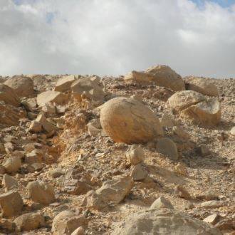
About a kilometer from the trailhead the path turns towards the right-hand bank of the stream, bypassing the huge canyon created by Nahal Grofit. The stream has great erosion effect, owning to the elevation difference of some 400 meters between Mount Ayit and the Arabah valley, as well as to the fact that the base of the mountain is composed of soft rock typical to the entire Ora Formation – making it extremely susceptible to erosion. The canyon itself is etched into the limestone of the Grofit formation.
Now the trail diverges from the bank of the canyon, widely bypassing it on the right, and ascending to the top of Mount Ayah – where the soft limestone of the Tzihor formation makes a large flat plateau. Nothing grows here, but this is also a great spot for magnificent moon vista.
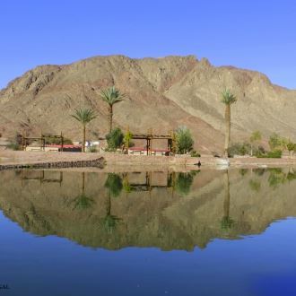
The trail approaches the cliff edge of Mount Ayah, revealing a magnificent view of the Arabah and the Mountains of Edom. Down below you can see the well-tended fields of Lotan and Ketura, and further north those of Yahel.
2. Mount Grofit
The trail descends from Mount Ayah and crosses a dirt road – this is the trail that follows the Trans-Israel pipeline, and it is marked red. After crossing that other trail, turn left, and after a few meters find the green trail again. The trail now follows one of the Nahal Ayah tributaries, bypassing the mountain in front of you. The streambed becomes increasingly narrow, until it disappears at once at the “knife” of Mount Grofit. The view of the Arabah from here is breathtaking.
The trail now diverges from the top of the Grofit cliff, but returns to it after a few kilometers. This is where the old argument is settled: the Haatakim cliff does extend to the edges of the Arabah and is not confined to the shores of the Dead Sea – and it is as gorgeous here as it is there. You can clearly see that the top of the Shayarot Cliffs, of which Mount Ayah and Mount Grofit are parts, serves as watershed between the streams flowing east towards the Arabah, and those flowing west towards the Uvda valley.
3. Nahal Kasuy
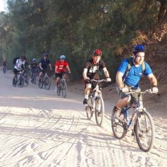
The trail descends from Mount Grofit, straight into Nahal Kasuy channel. At first we walk along the streambed surrounded by the desert that we saw earlier, but after 2.5 km and without warning the scenery changes abruptly: a large sand dune appears within the streambed, while the Mount Grofit slopes [?] remain made up of limestone alone. This is very unusual in Israel. The paved trail descending from the left bank of the stream is a segment of the Israel Bike Trail.
From here we walk about 2.5 km within the dunes that completely block the wide bed of the stream. The origin of these sands is in the center of the Sinai peninsula, where the rocks are composed of limestone, and have for the most part disintegrated into limey sand. The streams transferred these sands towards the Negev, while the winds drove them from the streambeds further towards the Uvda valley – until they got trapped in its north-eastern corner. This is why the sand in Nahal Kasuy is so rich with lime, and its grains are much smaller than the sand found on a seashore.
The trail passes along the left bank of the stream, but the dunes are wonderful to wander around. Among the local plants stands out the white saxaul, well adapted to growing on sandy dunes of a true desert. The sands absorb all the available rain water, missing not a drop. The white saxaul may reach two meters in height, and its roots dig deep into where the soil is wet even during the summer.
During the rainy winters the sands are covered with blooming plants, which is a feast for the eyes. Among the plants here are the zilla, two varieties of fagonia, the asteriscus, the erucaria, and the eremobium, as well as many other plants.
4. The Kasuy dune
Now the green-marked trail that you have been following again meets the red-marked dirt road. So far you have made 12 km. A walk to the right for about a kilometer leads to the Shaharut highway, while the way to the left, after about 1.5 km, reaches the famous Kasuy sand dune leaning against a tall limestone wall. The Israel Nature and Parks Authority cleared a campground next to the dune. You can complete your hike here, or you can go another kilometer to reach the Shaharut highway.
- Type
- Hiking
- Region
- Eilat
- Length
- 13 Km
- Duration
- 5-6 Hours
- Recommended season
- Spring, Autumn, Winter
- Difficulty level
- Medium
- Starting point
- Ayit Mountain, Eilat Mountains (map)
- Ending point
- Nahal Kasuy, Eilat Mountains (map)
- Special equipment
- Shoes, hat, a lot of water
- Precautions
- Where travel in the summer. On a hot day should bring a sufficient quantity of water
- Parking
- Parking
- Phone
- +972-8-6373057
- Fax
- +972-8-6326172
- haibar-yotvata@npa.org.il
Similar trails
Nearby attractions